Module 13: Sea Level Rise Policy
Module 13: Sea Level Rise PolicyIntroduction
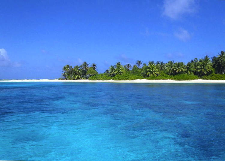
We opened Module 4, with the video Rising Sea Levels - Changing Planet, which began by describing some of the consequences to the world’s coastal communities of sea level rise. Dr. Ben Horton of the Earth Observatory of Singapore predicts that with more than 1 meter of sea level rise, social and economic consequences will include health problems, social problems, and political instability.
Already, coastal communities are experiencing more frequent flooding, poorer drainage, higher storm surge, increased shoreline erosion, and saltwater intrusion into surface and groundwater sources. Flooding is leading to damage and loss of infrastructure and peoples’ homes at an increasing rate around the world.

At this point in the course, you should have a pretty good understanding of ways in which sea level rise can impact human communities and ways in which communities have been responding up to this time. In Module 13 we will examine how communities can prepare for a future of higher sea levels through careful planning, We will also look at case studies to see how well the planning is going.
In Module 4 we discussed the current trend of increasing sea levels, and the projections for the future (look back at Recent Sea Level and Rise and Anthropmorpic Impacts). These projections point to global average increases in sea level of around 1 – 1.5 meters (3-5 ft) by the year 2100 or 80 years from now.
For many people, projecting 80 years ahead is hard to visualize and because they view it as beyond their lifetime experience, they find it hard to engage. The year 2050 is only 30 years away – a typical mortgage lifetime. Many coastal cities will see around 1 ft in increased sea levels by 2050 and, worldwide, millions of people will have to relocate due to persistent or repeated flooding, and related economic reasons. What impacts will this have in the next 30 years? What can we do to prepare for these sea level increases?
In Lab 1A (Module 1), you used a mapping tool to investigate projected chronic flooding impacts to coastal communities at different time frames, and the economic effects, particularly related to real estate, this may have on these communities. Additionally, in Module 4 Lab you used the NOAA Sea Level Rise Viewer to assess projected sea level rise impacts on Boston, MA, San Francisco, CA, and Grand Isle, LA. You have also considered many strategies – both structural and non-structural - for protecting coastal communities from the inevitable flooding that is and will be common-place as time progresses.
As you work through this module, keep in mind the following large-scale questions: If 30 million people must migrate away from coastal zones around the world by 2055, where will everyone go, and how will displaced people make a living? What social consequences are associated with large-scale migrations? How will these issues be addressed?
In the nearer term, we need to consider more tangible questions regarding adaptation to sea level rise on coastal communities, such as:
- What sea level rise policies are currently in place and are these policies adequate for the changing scenarios for our coastlines?
- What strategies can communities use to prepare for sea level rise, and who decides how what, where, and when regarding policy implementation?
- How will countries around the world fund sea level rise adaptation strategies?
John Englander’s 2013 book High Tide on Main Street: Rising Sea Level and the Coming Coastal Crisis addressed several important points regarding planning for sea level rise in coastal communities around the world. He stresses the importance of long-term thinking and the fact that people find it difficult to plan far into the future. He mentions that those reluctant to embrace the science of climate change often take issue with the uncertainty of future sea level projections. He makes the point that uncertainty should not prevent planning, because investors deal with uncertainty all the time. Importantly, he also points out that planning for 30 years is more manageable than 100 years, but policymakers need to also consider and base policy on what things will look like in 80 or 100 years to know where we are heading. Englander posits several “intelligent adaptation” strategies, including acting with a long-term perspective; expecting and accepting a range of projections and uncertainty; considering geology; recognizing that federal bailouts are not sustainable; and anticipating property devaluation.
These strategies are proving challenging to implement. Some coastal communities are leading the way in sea level rise adaptation planning and can serve as models for other communities to follow. We will look at some of these exemplary models and consider how efforts made today will benefit these communities in the future.
Goals and Objectives
Goals and ObjectivesStudents will assess how coastal communities can plan for and adapt to rising sea levels.
Learning Objectives
By the end of this module, students should be able to:
- critically examine the current state of sea level rise adaptation policy in the U.S.;
- consider the policy options for coastal communities at risk from sea level rise in the U.S. and around
the world; - assess how coastal community stakeholders work through the planning process, assess vulnerability
and adaptation strategy options;
Module 13 Roadmap
| Activity Type | Assignment |
|---|---|
| To Read/Watch | In addition to reading all of the required materials here on the course website, before you begin working through this module, please read the following required readings to make sure you are familiar with the content so you can complete the assignments. Videos
Reading
Extra readings are clearly noted throughout the module and can be pursued as your time and interest allow. |
| To Do |
|
Questions?
If you have any questions, please use the Canvas email tool to contact the instructor.
The Sea Level Rise Adaptation
The Sea Level Rise AdaptationRecall in Module 1 Lab 1A you responded to a prompt in a guided discussion using an interactive ArcGIS Story Map: US Coastal Property at Risk from Rising Seas. This tool allows the user to explore coastal communities and analyze the risks to properties in terms of flooding and financial loss. You can see the results for 2045 and 2100 shown spatially on the color-coded map. Some of the results are shocking. The year 2045 is 25 years away, so well within the lifetime of an adult who has a 30-year mortgage on a house in a flood risk zone. In many cases, jumping to 2100 gives a much more alarming view. One of the messages this tool provides is that sea level rise is happening now, not in an abstract way in the future, and that this generation must take action, and not leave it for future generations to address.
To this end, there are signs that more coastal communities in the U.S. are beginning to recognize the importance of sea level rise adaptation planning. On the other hand, a 2019 Climate Central analysis found that many cities are developing new homes faster in flood zones than in safer locations. New Jersey, Florida, and North Carolina stand out as the states building the most homes in flood risk zones. It is clear from these data that there is still a lot of work to do.
Climate Central has ranked U.S. cities based on their vulnerability to sea level rise: Go to Climate Central to view the three ranking lists. Note the three lists rank for, 1. Current flooding vulnerability (2017), 2. Flooding vulnerability in 2050, and 3. High social vulnerability populations at risk by 2050. All three of these lists rank New York city at #1 or #2, and the rest of the cities in the top 10 are in Florida. Note that the population exposed is critical to the ranking on these lists. Remember from Module 11 that the number of people exposed is a measure of vulnerability and social vulnerability (e.g., poverty, sickness, old age) increases the sensitivity of a community to sea level rise.
Please watch the PBS video below, Two cities, two very different responses to rising sea levels. It highlights and compares approaches to sea level rise planning in New York and Charleston, SC.
Video: Two cities, two very different responses to rising sea levels (9:19)
Two cities, two very different responses to rising sea levels
JUDY WOODRUFF: Tonight, the NewsHour begins a series on the way communities prepare and survive disasters, both natural and manmade. NewsHour special correspondent Jackie Judd brings us a tale of two cities, both on the Atlantic Seaboard.
JACKIE JUDD: The crane towering over Rockaway Beach is a symbol of New York City's urgent, almost frantic effort to prevent a repeat of what happened in 2012 when Hurricane Sandy nearly brought the city to its knees.
DANIEL ZARRILLI, Mayor's Office and Recovery and Resiliency, New York City: We have 520 miles of shoreline. We have always been at risk of coastal inundation, but Sandy really changed the way we think about that risk and how we engage with the waterfront.
JACKIE JUDD: The response is not simply about minimizing hurricane damage. The larger issue, the issue making hurricanes more destructive, is sea level rise caused by climate change and a warming planet.
BENJAMIN STRAUSS, Climate Central: We're not labeling things with sea level rise when we should be.
JACKIE JUDD: Ben Strauss is a scientist with the research organization Climate Central.
BENJAMIN STRAUSS: A storm comes in, we have a damaging flood, and we say we had a storm, we had a flood. But every flood is deeper, bigger, and more damaging because of the sea level rise we've already had.
JACKIE JUDD: In the last century, the sea rose at least eight inches, and the rate has been accelerating since the 1990s. In the Rockaways, Mayor Bill de Blasio, recently and with great fanfare, opened the first stretch of a new concrete boardwalk built above the floodplain to replace the wooden one Sandy destroyed.
BILL DE BLASIO (D), Mayor of New York: This is also part of resiliency because all of these measures will protect, not just the boardwalk, protect the community beyond the boardwalk.
JACKIE JUDD: The boardwalk, so close to homes and businesses damaged by Sandy, is designed to hold back storm surge. It is only a piece of a $20 billion blueprint resulting from a collaboration with the state and federal governments and climate change scientists. Dan Zarrilli, who oversees the city's efforts, says first came an assessment of the city's risks and vulnerabilities, and from there, the more granular questions, dealing with hardening old infrastructure and building new infrastructure to withstand poundings in the coming decades.
DANIEL ZARRILLI: Even just considering the 2050 scenarios, about 8 percent of the city's shoreline could be flooded on a daily basis, just due to high tide, not even during a coastal storm event. And so thinking through the implications on neighborhoods, the investments we need the make to reduce risk and to handle that level of inundation is something that's driving our policies around our entire coastal protection plan.
JACKIE JUDD: New York City's aggressive efforts to prevent future catastrophe is not an approach that all cities facing rising sea level rise and other consequences of climate change are following. Take Charleston, South Carolina, which is known as low country for a reason. This spot just near the center of the city is only several feet above sea level. Sandy Bridges owns a small boutique nearby, in Charleston's vibrant Tourist District.
SANDY BRIDGES, Business Owner: High tide, rainy day, we just always experience flooding here.
JACKIE JUDD: Guaranteed?
SANDY BRIDGES: It comes right up to my doorstep on a really heavy downpour.
JACKIE JUDD: This is what it looked like near her store in 2012 after Hurricane Isaac brushed by the city. The fast-growing region is one of the Eastern Seaboard's most vulnerable. Waterways snake through the city and neighborhoods have been built on landfill. Flooding has plagued the city for generations, but it's getting worse.
CHRIS CARNEVALE, Southern Alliance for Clean Energy: At a particularly high tide, floodwater already comes in through the seawall and through the sidewalk and it fills the street right here at this intersection.
JACKIE JUDD: Environmentalist Chris Carnevale says sometimes it doesn't even take rain during an unusual high tide to trigger what the locals call nuisance flooding.
CHRIS CARNEVALE: We used to see about four-and-a-half days of nuisance flooding per year in the mid-20th century. Now we're up to about 23 days per year. When we project that into the future, as seas continue to rise, that's going to look — that's going to be many more days per year.
JACKIE JUDD: Even so, business owners, scientists, and environmentalists say, unlike New York, officials are moving too slowly in planning and seeking the necessary funds.
FRANK KNAPP, South Carolina Small Business Chamber of Commerce: They are taking some efforts, but those efforts are simply very inadequate.
JACKIE JUDD: Frank Knapp organized small business owners to agitate for swifter action. They have posted blue tape on door fronts to remind tourists of the flood line in a surge.
FRANK KNAPP: When the public actually takes the time to learn about the inundation threats under very small levels of sea level rise, one or two feet, I think they're going to be very shocked and they're going to be demanding that the city start doing some planning.
JACKIE JUDD: It's been more than a quarter-century since Charleston had its Sandy, Hurricane Hugo in 1989. So that sense of urgency is absent. And in a politically conservative state such as South Carolina, climate change is a difficult subject.
BRIAN HICKS, The Post and Courier: They put that report in a drawer. They didn't want it to see the light of day.
JACKIE JUDD: Political columnist Brian Hicks says, in 2011, scientists at the state Department of Natural Resources produced a report intended to sound the alarm, but political appointees shelved it.
BRIAN HICKS: When they did finally release it, they changed the executive summary, and there were all these things about, you know, that some scientists think this, and some scientists think that. It was very much a denial factor here, and they deep-sixed it.
JACKIE JUDD: Predictions for sea level rise in the next 100 years range from one foot to six feet. In Charleston, the creeping blue in this government map shows flooding that would occur at high tide with one to five feet of sea level rise. The higher-end would wreak havoc. Liz Fly is part of a team of state scientists overseeing coastal conservation.
ELIZABETH FLY, South Carolina Sea Grant Consortium: There is the risk and likelihood of some communities going underwater with increased sea level rise.
JOSEPH RILEY, Mayor of Charleston, South Carolina: Climate change is not going to remove Charleston from the landscape.
JACKIE JUDD: Joe Riley is the longtime mayor of Charleston.
JOSEPH RILEY: There's no cause for — to despair. It's all — the incremental improvements will protect this beautiful, historic city.
JACKIE JUDD: The most significant improvements to date, according to Mayor Riley, are fortifications to the battery at the point of the Charleston Peninsula, and this extensive new drainage system designed to pull water out of the city as fast as it comes in. But there is no broad adaptation plan in place. Are you planning on a one-foot rise? Is that the working assumption?
JOSEPH RILEY: We're planning on a range. It's incremental. We — and each year or decade, you will further calibrate that.
JACKIE JUDD: What is the range?
JOSEPH RILEY: Well, the range, you need to ask our resiliency people, but we're — we see some — some a foot, some less than a foot, some more than a foot.
JACKIE JUDD: Mayor Riley later clarified that he wasn't suggesting one foot was adequate for planning and described the drainage project as only a serious beginning to Charleston's preparations. Still, the administration has significant catching up to do.
ELIZABETH FLY: It's important for a community to look at that range of scenarios and think about their risk management, and think about what decisions are high-risk, and so maybe you should plan for a more extreme case of sea level rise, while some other decisions, it might be OK to plan for.
JACKIE JUDD: But that — that has not been decided in Charleston, right?
ELIZABETH FLY: No.
JACKIE JUDD: New York City's robust approach is more the exception than the rule along the East Coast, especially among smaller cities like Charleston.
BENJAMIN STRAUSS: This is a hard issue to really digest and tackle. We have no legal precedent, we have no institutional precedent for the idea that land will be disappearing. And we're ultimately going to need to take a very deep look at it to preserve the heritage of our city.
SANDY BRIDGES: One hundred years ago, they started planning and preserving and conserving Charleston. And 100 years from now, I want another little local business owner to be able to stand here and say the same thing. So, that's what honestly concerns me, is that 100 years from now, this could be lost.
JACKIE JUDD: Charleston Mayor Riley compares the threat of rising sea to an enemy invasion, which is just how New York City is behaving as it builds new defenses. For both cities, there is no doubt that the enemy is on the horizon. For the NewsHour, this is Jackie Judd in Charleston.
Learning Check Point
Take a few minutes to answer the questions below to test your knowledge.
Strategies for Building Coastal Resilience and Planning for Sea Level Rise Adaptation
Strategies for Building Coastal Resilience and Planning for Sea Level Rise AdaptationA coastal community can take concrete steps to become more resilient to the impacts of rising seas. A great deal of effort is underway to guide communities in the planning process for sea level rise adaptation, using a science-based process. The Sea Grant program under the National Oceanic and Atmospheric Administration (NOAA) is leading this process in many coastal counties. The Sea Grant Program is a federal-university partnership program that “brings science together with communities for solutions that work”.
We will look at the planning process that coastal communities are currently implementing around the U.S., including examples in North Carolina and Florida.
To begin, watch the video below from the Module 13 Roadmap Effects of Rising Sea Level on Coastal North Carolina - "Sea Change" - A WRAL Documentary below.
Video: Effects of Rising Sea Level on Coastal North Carolina - "Sea Change" (21:53)
Effects of Rising Sea Level on Coastal North Carolina - "Sea Change"
The following program is shot in 4k high dynamic range and broadcast in high definition from Capitol Broadcasting Company.
[Music]
Bill Leslie, WRAL-TV: The sea has been rising for thousands of years.
Man: It continues on this upward, increasing pattern.
Leslie: Scientists predict about a three-foot rise in sea level along our coast by the end of the century.
Man: This is not something we have to deal with a hundred years from now, we have to deal with it right now.
Leslie: But beach communities are dealing with sea level rise right now.
2nd Man: We are retreating by default.
Leslie: Mainland coastal communities are dealing with it too.
Woman: They have water that they need to move now.
Leslie: Saltwater is invading forests and farms.
Man: Some of these fields here are at or below sea level.
Leslie: It's inundating a federal Wildlife Refuge.
Man: There's places that are eroding on average 45 feet a year.
Leslie: Across northeastern North Carolina, water is pumping, dikes are blocking, and homes are rising.
Man: Being up here you feel a lot better.
Leslie: But sea level isn't rising above politics.
News Reporter on TV: The law makes it illegal for North Carolina to consider scenarios of accelerating rates of sea-level rise.
Woman: We're made fools of.
Man: Sea level rises is not a theory, it's a measurement.
Leslie: With a measure of uncertainty for our coast.
[Music]
Leslie: Ben Huss is a bail bondsman in Newton, North Carolina.
Man: ...check on his court date, make sure he hadn't already missed it.
Ben Huss: You are a modern-day bounty hunter when the guy doesn't show up for court.
Leslie: The job is risky.
Huss: The bigger bond, you know that's more risk for us. But it's also more money in your pocket. Here he is.
Leslie: So what is the connection between a bail bondsman in Newton and sea-level rise? Well, Huss is also the owner of this beach house made famous in the 2008 movie Nights in Rodanthe starring Richard Gere and Diane Lane.
Diane Lane: Four nights, leaving Tuesday.
Richard Gere: Pretty early. I've got a flight to catch.
Huss: I was just enthralled with it, with the movie and the house also. At high tide, the water was coming under the house, and at low tide, it would come up to the front steps.
Leslie: Huss decided to take another risk. He bought the house in 2009.
Huss: I was going to save that house to the extent that I would probably die trying.
Leslie: Huss hired the same contractor who moved the Cape Hatteras Lighthouse in 1999.
Huss: They tell me in one hour the house is going down the road.
Leslie: He moved the house nearly 300 feet from the ocean, but the ocean is following.
Huss: So now we're down to about 250 feet. There is something to the global warming in our environment, with the hotter temperatures. It's making oceans rise. That's a big enemy of any any house that's on the coast.
Leslie: Sea level rise makes erosion worse. Erosion has cost Nags Head several rows of houses over the years.
Man: They seem to be the poster child and the picture of sea level rise, which we don't want to be that.
Leslie: From 1870 to 1924, global sea-level rise has been less than a millimeter a year.
Stan Riggs, Coastal Geologist: The process of sea-level change on a global basis it's really a slow, gradual process. It's like filling your bathtub gently.
Leslie: But Riggs says global sea-level rise is accelerating. Since 1993, the rate has quadrupled to 3.2 millimeters a year. He says sea level rise is accelerating because climate change is warming the oceans. Here in North Carolina, tidal gauges show the rate of sea level rise is less than the global average
Spencer Rogers, Geologist: On average sea level has been rising annually about the thickness of a nickel every year, for at least the last 80 years.
Leslie: But Rogers expects that to change.
Rogers: We think sea level is going to accelerate in the future, even though we haven't seen it in the historical record of our gauges. But it's almost certain to occur in the future.
Leslie: Right now, scientific projections are for sea level along our coast to rise anywhere from 15 to 55 inches between now and the end of the century, with a 39-inch rise being the most likely scenario. Just a 2-foot rise in sea level would inundate much of the Outer Banks. Just imagine places like Rodanthe underwater. Sea level rise is already causing higher storm surges and more flooding. Just last month, Hurricane Jose caused overwash that came through some beachfront homes and flooded highway 12, even though its center was 300 miles offshore.
Rogers: If we look at how we're managing those threats, immediate threats, today we're not doing a very good job of handling the immediate threat.
Leslie: The town of nags head has been dealing with the shoreline threat through beach renourishment.
Cliff Ogburn, Nags Head Town Manager: Our will is to continue to nurse the beach as long as we can afford to do so. And as long as we have a sand resource that we can replenish the beach with, we're gonna continue to maintain the beach.
Leslie: The town has also required new homes to be built further from the ocean and higher in elevation. The problem is, there's little room left for new construction. The town is nearly 90% developed.
Ogburn: I wish 30 years ago they knew then what we know now.
Leslie: Lawsuits have hampered the town's ability to move homes out of harm's way and condemn and remove ones already on the beach.
Ogburn: We lost some of our appetite for this because the legal challenges are expensive and they do cost the taxpayer quite a lot of money to deal with these.
Leslie: Meantime, sea-level rise is also affecting groundwater.
Ogburn: It's rising and it's rising fairly quickly.
Leslie: Which contributes to flooding during heavy rains. Last month, the town of Nags Head adopted a comprehensive study that identifies and prioritizes its vulnerabilities to sea-level rise.
Ogburn: Regardless of where you fall on the science, and how much it's gonna rise and how fast, and how much, it seemed irresponsible for us to not plan ahead.
Leslie: The town solicited input from residents and business owners. It even formed a climate change and sea level rise adaptation committee.
Ogburn: And then we started rewriting our codes, or addressing climate change and sea-level rise into our building codes.
Leslie: North Carolina Sea Grant partnered with the town to develop the study and use it to start developing an adaptation plan.
Jessica Whitehead, NC Sea Grant: We've had elected officials there who have been engaged through the entire process. They're really serious about making this happen.
Leslie: The plan will focus on critical infrastructure over commercial and residential development.
Whitehead: To really begin thinking about, okay, at what point are we going to have a problem, at what point do we reach a threshold where we will have some negative consequences, and how do we keep that from happening?
Leslie: For the town of Nags Head, the overriding goal is to stay put as long as possible.
Ogburn: You know, we can't relocate. We can't pick up the town and move anywhere else.
Huss: So from originally built, in this picture, with 400 feet of beachfront, down to no beachfront.
Leslie: Benn Huss already moves his beloved Nights in Rodanthe's house once. He's hoping he doesn't have to move it again.
Huss: We're hoping to get 15 more years, maybe, before the water comes up to the edge and up to the front steps. And it'll be there for who knows how long.
Leslie: With a 1.2 billion dollar annual tourism economy, the Outer Banks may get most of the attention when it comes to sea-level rise. But next, the impact may be even greater further inland.
Brian Boutin, Nature Conservancy: What we're seeing here is erosion rates anywhere in the range of 5 to 15 feet per year. In some places, we're getting as much as 45 feet a year.
[Music]
Leslie: When Hurricane Emma threatened North Carolina last month, Hyde County Water and Flood control coordinator Daniel Brin went out to inspect the dike and tidal gates. They help protect the community of Swan Quarter.
Daniel Brin, Hyde County: Make sure that any debris that's holding gates opened that would allow tidewater to seep past.
Leslie: The gates help keep out salt water from storm surges and allow fresh water from heavy rains to drain to help prevent flooding. Swann Quarter is the county seat and where most of the county's 5,500 residents live. The County started construction on this 11-mile dike in the mid-80s to help protect Swann Quarter from storm surge coming off nearby Swann Quarter Bay and the Pamlico Sound. The county sped up dike construction after Hurricane Isabel flooded Swann quarter in 2003.
Brin: Isabel was a huge wake-up call.
Leslie: The dike was completed just before Hurricane Irene in 2011 and saved the town from Irene storm surge.
Brin: Right here, where you're looking now, the water was maybe three or four inches from the top of the dike. And inside you and I would be standing on grass right here.
Leslie: But the entire county is vulnerable to flooding. Most of it is less than three feet above sea level.
Brin: About 85% of the county's within the hundred-year flood plain.
Leslie: The county has a network of drainage canals and pumping stations.
Brin: And this pump is used to remove water from the agricultural land and improve land upstream, to lift it and then to move it out work on to the Pamlico Sound.
Leslie: Saltwater can ruin farmland, risking the county's nearly two hundred million dollars in annual crop sales.
Mike Burchell, NC State Professor: t's a constant battle against the water down here in hide county.
Leslie: This shows just what farmers here are up against. The same storm surge from Jose pushed this salt water three miles inland from the Alligator River and into a drainage ditch alongside Hyde County farmland. Local farmers plug the ditch to try to keep the water out but the plug is failing.
Burchell: They're seeing more evidence that salt water is moving into these canal systems and influencing negatively their agricultural production.
Leslie: Burchell is an NC State professor doing research to try and help.
Burchell: We're trying to see how much the waters rising and how salty that water is, at these different locations.
Leslie: Burchell hopes he can help farmers improve existing infrastructure and develop new technologies to battle saltwater intrusion into their fields.
Burchell: As long as it makes economic sense, they'll fight.
Leslie: The fight will get tougher. This graphic shows just how a two-foot sea level rise would inundate much of the Albemarle-Pamela Peninsula, including much of Hyde County. It would put communities like Englehart underwater.
Stan Riggs: We have many shorelines that are less than 1 foot in elevation. And if you raise it two feet, we've got the better part of six counties that are gone. They're underwater. They're going underwater right this minute.
Leslie: Like Nags Head, Hyde County partnered with North Carolina Sea Grant to develop a plan to adapt to sea level rise. It focuses more on immediate, rather than long-term, threats.
Whitehead: Because if you're not there five years from now, you can't be there thirty years from now.
Leslie: The county identified problem areas, examined infrastructure improvements, and published a flood guide for residents. It also helped identify homes that need to be elevated. Chris Hilbert helps provide grants through FEMA's National Flood Insurance Program to cover the cost of elevating homes.
Chris Hilbert: We had a recent house that was paying about four thousand dollars a year in flood insurance and when they got renewed, after the elevation, it reduced down to four hundred dollars.
Leslie: More importantly, it gets people like Bertha and Solomon Cooper out of harm's way. Their house in Swan Quarter flooded three times.
Solomon Cooper: We had just about four foot of water each time.
Leslie: The last time was during Hurricane Irene. Cooper's home was on the wrong side of the dike and filled with water.
Woman: They lost everything.
Leslie: Hilbert helped Cooper get a grant to tear down his old home and build a new one that's elevated and in a less flood-prone area. Cooper says he feels much more prepared for the next storm.
Cooper: Well you feel a little better now. You know you probably have something to come back to, you know.
Leslie: Like many Hyde County residents, Cooper plans to stay.
Brin: The people here in Hyde County are resilient folks, that's why we're still here now.
Leslie: And they understand the risks.
Brin: Nowhere else in the state I would think you would get a broader consensus that sea-level rise is real than you would here in Hyde County.
Boutin: This road used to extend well beyond where that piling is out there in the water. Just a few years back, just five years ago.
Leslie: The Nature Conservancy's Brian Boutin points out the land that's being lost to sea level rise in the Alligator River National Wildlife Refuge. The refuge covers 157 thousand acres of mainland Hyde and Deer counties. And by the end of this century...
Scott Lanier, Refuge Manager: ..a lot of the refuge could be underwater.
Leslie: Scott Lanier was one of the original three employees of the refuge in 1985. He left in 1991 and returned 25 years later.
Lanier: I just looked around and thought , my word, what is happening in this place? This change in habitat is is really unreal. What's going on?
Leslie: Marshes had turned to open water, land into marsh, and woods into ghost forests of dead trees.
Lanier: The easy button would be. oh well. you know there's nothing we can do. What's gonna happen is gonna happen. We're not gonna do that.
Leslie: Instead the refuge partnered with the Nature Conservancy on a project to adapt to sea level rise. Water control devices have been installed.
Boutin: What we're actually doing is creating more of a system where the freshwater is pushing the salt water back towards the sound.
Leslie: More salt-tolerant vegetation is being planted and oyster reefs have been installed to slow down shoreline erosion.
Boutin: ...and that helps to keep this ecosystem intact. It helps to slow the rate of erosion to something that's more natural and something that we would normally see in an area like this.
Lanier: You're preparing for what's gonna happen in the future and just slowing that whole rate of change down.
Leslie: Giving the wildlife here a better chance to catch up, adapt, or migrate inland.
Lanier: We're hanging on to what we got as long as we can.
Leslie: Next, successfully adapting to sea-level rise may mean putting policy over politics.
Unfortunately, sea-level rise and climate have become political issues, not science.
Stephen Colbert on TV: If your science gives you a result that you don't like, pass a law saying that the result is illegal. Problem solved.
Leslie: That's comedian Stephen Colbert lampooning our state legislature in 2012. It was over a law that prohibited coastal communities from using a state science panel report that looked at sea level rise projections to the year 2100. The panel later amended the report to look out only 30 years. That, of course, makes the projections look less dire. A probable rise of 7 to 12 inches instead of 15 to 55.
Riggs: It's important to show what's vulnerable out here.
Leslie: Coastal geologist Stan Riggs served on that panel.
Riggs: What the state of North Carolina did was throw that part of the coastal system under the bus. They threw the science under the bus, but they also threw the people under the bus.
Leslie: Riggs says the state can't properly plan major infrastructure projects like the new 100-year Bonner Bridge, if it's only looking at 30-year sea level rise projections. NC20, a group representing the state's coastal counties, pushed for the change.
Riggs: With the idea that the public will rebel against this, they won't come to our beaches anymore, it's gonna kill the coastal economy.
Leslie: But NC-20 says it was more about the initial report taking away local control.
Willo Kelly, President, NC-20: And it said in the report, that local governments shall, and the one thing you learn when you're looking at any legal document or legislation, there's a big difference between shall and may. And it said local government shall use a a kind of an official rate of sea level rise in local planning purposes.
Leslie: Kelley says planning for an uncertain scenario more than 80 years out is unrealistic for coastal communities.
Kelly: Climate change it's a certainty. Modeling though is not a certainty. I think the 30 years everyone could kind of wrap their heads around it and understand it.
Leslie: And she says communities can still look at the longer projections if they choose to. Spencer Rogers, who also served on the state science panel, agrees that the 2100 timeline is too distant.
Rogers: The problem is that our ability to predict that far in the future gets weaker and weaker with what evidence we have in hand and what we're able to model.
Leslie: As for future sea-level rise planning, a recent study by NC State and Appalachian State Universities found that most coastal communities are doing little to none. But the study also shows that the more certainty there is in predictions and impacts, the more willing communities are to plan.
Brian Bulla, Associate Professor, ASU: The evidence for these coastal officials will continue to come in and hopefully that will increase their comfort level and ability to to make some adaptive actions.
Leslie: Right now Nags Head and Wilmington are the only coastal communities that specifically mentioned sea level rise in their comprehensive plans.
Rogers: Unfortunately sea level rise and climate have become political issues, not science. But the good news is, they're often making the same decisions they would need to do for sea level rise adaptations, for other coastal hazard reasons. So they're there making changes for coastal hazards, they're not necessarily doing it directly for sea-level rise. And that's understandable because it's a lot more immediate threat for a hurricane this year than it is for sea level rise 100 years in the future.
Leslie: More coastal communities are requiring home foundations to be higher.
Riggs: We can engineer our way out of a lot of things, but not everything. At some point, you've got to back off.
Leslie: And while there has been some notable backing off on the Outer Banks, people there say total retreat is not realistic.
Kelly: Is there an expiration date for the Outer Banks? I have no idea of knowing that. And I know that we're going to go along, and do what we need to do, and do the best that we can do today, and in planning for a future, and protect our livelihoods, and protect our culture.
Leslie: And in 2100...
Kelly: Will it be here? Will it not be here?
[Music]
Kelly: And none of us can answer that question and we're not going to be here to know it.
This video features the efforts to address planning for sea level rise in the community of Nags Head, NC in the Outer Banks. The North Carolina Sea Grant Program assists the town in developing planning strategies, which are outlined in the document Coastal Resiliency & Sea Level Rise Planning.
Learning Check Point
Example of Obstacles to Adaptation
Example of Obstacles to AdaptationToms River, New Jersey
A look at Toms River, a coastal town in New Jersey, as told in the book “The Water Will Come” by Jeff Goodall, provides us with some more insight into some of the obstacles to sea level rise planning in the U.S.
Toms River, NJ is an example of a community that is reluctant to embrace change even with ample evidence that business as usual could lead to catastrophic losses in the future. Data are readily available for how rising sea levels affect property in coastal communities along the Atlantic coast. The data show that sea level rise will negatively affect the real estate industry, with repeated flooding and consequently reducing home values. The economic impact on tourism will be devastating. Hurricane Sandy damaged or destroyed 10,000 homes, and nearby Ortley Beach fared worse. A lot of work went into planning efforts to redesign these communities to adapt to the changing climate and higher sea levels of the future, including relocating some properties. However, despite these efforts, community leaders rejected the plans, and the town rebuilt the damaged property in the same location, elevating homes to a new level and reinforcing the dunes as protection. Toms River is not alone. Communities along the Atlantic and Gulf coasts resist change and choose to rebuild in place rather than take a long-term approach and begin to address the problems that will only get worse. The reasons are many, but to effect change, there must be political will and a desire for change in the community, which are presently lacking in many places. Although doubtless, some residents of Toms River and other communities impacted by the combination of sea level rise and storm surge do decide that they cannot risk another flood and move to a safer location, typically, people make decisions based on their personal financial situation and emotion. The example of Isle de Jean Charles in Louisiana that we covered in Module 9 exemplifies how challenging it is to implement the relocation of a community when people are attached to their homes and communities and depend on the place for their livelihoods. So, what will it take to overcome the challenges and implement successful plans for adaptation? Currently, with each successive catastrophic storm, people react and some leave while others dig in and use the resources available to rebuild.

In Module 12 you read about the National Flood Insurance Program (NFIP) and its financial insolvency. Many point to the reliance of homeowners on subsidized flood insurance to bail them out after each successive flood as one of the key incentives for rebuilding in place and for the complacent attitude towards sea level rise warnings.
It is clear that, if coastal communities are to implement sea level rise adaptation strategies, large policy changes are needed, and to effect these changes, shifts in political views and the fundamental ways people think about their relationship with their coastal communities will be necessary in many places.
Sea Level Rise Adaptation Planning
Sea Level Rise Adaptation PlanningAs evidenced by Climate Central’s ranking of U.S. cities vulnerable to sea level rise, Florida is the most vulnerable state in the U.S. to sea level rise, with its long, highly developed coastline, porous limestone bedrock, and exposure to tropical cyclones. More people and their property are at risk from sea level rise flooding in Florida than any other state.

We will use the document Sea Level Rise Vulnerability: Assessment Tools and Resources: A Guide for Florida's Local Governments (reading #2 in the Module 13 Road Map), as well as the more generalized materials from the Climate Resilience Toolkit to analyze and understand the planning process. The Florida guidebook provides guidance for approaching, developing, and completing sea-level rise risk and vulnerability analyses and scenarios and for incorporating the appropriate processes into local planning efforts. The document outlines the four major components or phases of sea level rise adaptation planning.

- Collaborate and define the planning context - This includes a survey of the physical, social, infrastructure, and environmental conditions (similar to your CVAT survey for the Capstone Project); determining goals, objectives, and principles; assembling a steering committee of community stakeholders and experts; and surveying past adaptation planning efforts.
- Identify your community’s vulnerabilities - A vulnerability (or risk) Assessment involves looking at the exposure, sensitivity, and adaptive capacity of the community (as described in detail in Module 11). There are many tools available to determine vulnerability. One example is the NOAA Sea Level Rise Viewer, which we used in Module 4 lab. In addition to visualization tools, modeling, and decision support tools are implemented.
- Determine strategies to address vulnerabilities - The development of adaptation strategies is based on the results of the vulnerability assessment. The strategies identified in this step can fall into several categories, including Protection, Accommodation, and Retreat. We considered protection, accommodation, and retreat strategies in Modules 8 (hard and soft engineering strategies), 9 (managed retreat strategies), and 10 (smart building).
- Implement - Implementation involves identifying and securing funding for implementing the strategies outlined in the third step. It also identifies who will perform implementation tasks, writing implementation plans, and determining how they will be integrated into existing plans, and how they will be evaluated.
Steps to Resilience
Steps to ResilienceThe Climate Resilience Toolkit provides more generalized, but clear guidance for communities working towards increasing climate resilience – in the face of many types of climate stressors. It provides excellent videos to explain each step in the process, which is similar to the Florida guidebook.
Take a look at the following pages of the Climate Resilience Toolkit.

The website provides clear guidance in a series of short videos that cover the “Steps to Resilience” and each step has an explanatory video. Please visit each page and watch the video for that step:
- Explore Hazards Explore Hazards
- Assess vulnerability and risks Assess vulnerability and risks;
- Investigate options; Investigate options
- Prioritize and plan Prioritize and plan and
- Take action Take action
Identifying Stakeholders
Identifying StakeholdersWho decides how to prepare for sea level rise?
During the adaptation planning process, organizers are encouraged to assemble a steering community of community stakeholders. Stakeholders are individuals or groups who have something of value that may be affected by coastal hazards or by the actions taken to manage coastal hazards.
This is a very important step to ensure the success of the adaptation planning process, which as we saw in the vignette about Toms River may be a contentious process if there are widely differing viewpoints among the stakeholders. Everyone living and working in a coastal community, as well as many organizations, local, state, and federal government entities, corporations, and other businesses operating in the community, have an interest in preparing for sea level rise.
It is important that there is a diverse representation on the stakeholder steering committee. Failure to respect the democratic process, by excluding stakeholders from the decision-making process can lead to negative consequences and distrust of government, among other things. Encouraging broad participation can result in better decisions in the long run. A diverse set of stakeholders can bring valuable wisdom beyond that held by specialists only, and provide essential information to the decision-making process.

Identifying stakeholders
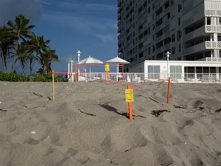
Identifying which types of stakeholders should be included in sea level rise planning activities can be challenging. One approach is to begin by brainstorming a list of all persons or organizations in a community that may be affected either by sea level rise or by sea level rise policy. These people or organizations will usually live, work, or have some other significant presence in the community. However, it is sometimes advisable to include stakeholders from outside the community, such as representatives from the state or federal government. For example, if endangered sea turtles are known to nest along a U.S. community’s shore, then it may be helpful to include representatives from the U.S. Fish and Wildlife Service as a stakeholder in the planning process – particularly if protection strategies under discussion include sea walls or other strategies known to be harmful to the turtles.
Learning Check Point
Florida Stakeholders
Required Reading
Take a few minutes to read, Up Against the Seawall, a news article about Florida stakeholders’ legal battles over beach erosion, sea wall construction, and sea turtle habitat.
Think about what you just learned, then answer the questions below. This exercise is not for credit, but you are required to understand this material for this module.
Participatory Planning Process
Participatory Planning Process
Bringing together a diverse set of stakeholders can prove challenging – especially for discussion of politically charged issues such as sea level rise. Participatory planning is one approach for bringing diverse and marginalized groups into the planning process while also avoiding conflict. The participatory planning approach emphasizes the participation of local stakeholders – that is, those people who live and work in the communities that will be directly affected by the adaptation or mitigation measures under discussion. Participatory planning empowers local stakeholders by directly involving them in the planning process. Planning workshops are led by skilled facilitators who design the meetings so that all people present have a voice by encouraging all the stakeholders to participate in brainstorming, investigating, and analyzing options for preparing for sea level rise (or other hazards). Stakeholders are generally asked to break into small groups to discuss these options before sharing their ideas about them with the facilitators and other groups. Stakeholders may then use cost-benefit analysis to choose which of these options are most suitable for their community.
For hazards such as sea level rise that have a strong spatial component, participatory planning exercises typically use interactive mapping tools, such as the NOAA Sea Level Rise Viewer, to help stakeholders better understand both the hazard and the options for addressing it. In participatory mapping, stakeholders interact with maps with information relevant to the planning task. Interactive, digital mapping tools are valuable for illustrating what the mapped area might look like under different hazard scenarios and planning options. Stakeholders then use these maps to explore these scenarios and options. Stakeholders may have the opportunity to annotate maps with questions, concerns, and other notes about how each combination of scenarios and options might affect a particular stakeholder or area of the community, and tp share these ideas with facilitators and other stakeholders. These maps will often show: which areas of the community are susceptible to flooding under different amounts of sea level rise (either on its own or in combination with storm surge); and how planning options (such as building a seawall or restoring wetlands) may mitigate this flooding. These interactive sea level rise maps are then used to determine where in the community these adaptation strategies and options are most needed or appropriate.

Considering Views of Vulnerable Stakeholders
Coastal communities often find that decisions about what people and places to protect first are particularly challenging. As discussed in Module 11, vulnerability provides one way to prioritize protection for different areas. By using the vulnerability scoping diagram (VSD; see Module 11) in participatory planning exercises, communities can encourage stakeholders to brainstorm components and measures for the three dimensions of vulnerability (exposure, sensitivity, and adaptive capacity). Completing the VSD in a public forum can help stakeholders and discussion leaders to better understand which dimensions and components of vulnerability different community members and experts believe are most important; measures for these most-important components can then be mapped to indicate areas that are most in need of protection. For example, if a participatory VSD indicates that community members see the exposure of low-lying areas to sea level rise-enhanced storm surge and sensitivity of low-income groups as the two most important components of vulnerability, then elevation and census data can be used to identify areas that are low-lying and have a high percentage of persons in poverty. These areas would then be given first priority when considering strategies for preparing for sea level rise and related coastal hazards.
Selecting Strategies
Selecting StrategiesCommunities can use two broad types of strategies for preparing for sea level rise and related hazards: structural and non-structural. Structural strategies involve direct manipulation of the coastal environment through the construction, removal, alteration, or restoration of coastal structures, including both human structures (such as homes, businesses, and sea walls) and natural structures (such as dunes, beaches, mangroves, and oyster beds). Non-structural strategies are changes to coastal policy that encourage citizens, businesses, and governments to take steps to protect themselves from sea level rise and related hazards, but do not require specific structural responses.
Structural Strategies
In Module 8, we explored various types of structural options for coastal protection, including hard and soft engineering. In Module 9, we explored several non-structural options that can be classified as managed retreat. In Module 10 we looked at smart building options, and in Module 12 we considered structural and non-structural mitigation policy. So, by now, you should have a good idea of the adaptation options available to a sea level rise planning group as they make their selections during the planning process.
Below, we have listed strategies and their potential costs and benefits.
| Structure Type | Potential costs | Potential benefits |
|---|---|---|
| Dikes | Vulnerable to wave action and erosion | Excellent protection against storm surge and moderate sea level rise |
| Seawalls | Expensive to build; enhances erosion on the seaward side of the wall; limits access to and views of the water | Strong protection against storm surge, waves, and sea level rise |
| Breakwaters | Provide only limited protection against storm surge and do not protect against sea level rise | Protect against waves and erosion |
| Groins | Encourage down-drift erosion | Provide limited protection against waves; can encourage up-drift accretion of sand and sediment |
| Jetties | Encourage down-drift erosion | Stabilize and protect navigation channels at river mouths and tidal inlets |
| Structure Type | Potential costs | Potential benefits |
|---|---|---|
| Living shoreline | Can be over-topped by high storm surge | Strong protection against erosion, moderate protection against low storm surge and wave action; if not blocked by roads, buildings or other impermeable cover, can retreat shoreward with sea level rise |
| Dune restoration | Subject to erosion, may periodically require expensive re-nourishment with sand | Provides strong protection against waves, most storm surge, and moderate sea level rise |
| Structure Type | Potential costs | Potential benefits |
|---|---|---|
| Managed retreat | Moving or demolishing the most vulnerable structures can be very financially expensive and can damage the local community and economy if not done with care and sensitivity | Can significantly reduce potential loss of life and property by moving homes and business out of the most exposed locations |
| Multi-layered protection | Generally more expensive and complicated to implement than single-layer strategies | Can significantly reduce exposure compared to single-layer strategies |
| Structure Type | Potential costs | Potential benefits |
|---|---|---|
| Elevated construction | May not protect against waves; can add significantly to cost of construction | Protects against storm surge, applicable to many different building types |
| Floating construction | Does not protect against wave damage; difficult to implement for many building types; difficult to connect utilities | Strong protection against storm surge and gradual sea level rise |
Non-Structural Strategies
| Non-structural strategy | Potential Costs | Potential Benefits |
|---|---|---|
| Insurance | Can encourage those who can afford premiums to remain in high-risk areas | Supports disaster recovery; can incentivize structural protections or retreat |
| Zoning | Rezoning or establishing special sea level rise overlay zones can be politically contentious, depending on the prohibitions and restrictions proposed for the new zones; zoning allowing or encouraging hard armoring can cause erosion and other negative environmental effects | Flexible tool that can prohibit new construction, rebuilding, or renovation in high risk areas; protect environmentally sensitive areas; or specify the types of structural protections that may be used in an area |
| Flood plain regulation | Often used to enforce building codes but not for more protective prohibitions/restrictions on construction; National Flood Insurance Program (NFIP) flood plain zones are based on historical flooding and do not account for sea level rise | Can be used to restrict what can be built in flood plains and/or how such structures can be built (e.g., elevation and anchoring requirements); required for community participation in NFIP |
| Building codes | Can be costly when retrofitting existing development; may provide inadequate protection for extreme sea level rise-enhanced storm surge events | Easy to implement for new development; can reduce insurance premiums |
| Tax breaks | Can reduce tax revenue | Can provide politically popular incentive to steer development away from high-risk areas |
| Direct payments | Direct payments for acquiring high-risk properties can be expensive; some property holders may not be willing to sell | Purchased land can be used for environmental restoration and can provide buffer against surge and erosion for adjacent properties |
| Real estate disclosures | Requires expensive sea level rise modeling to determine geographic extent of notification requirement; may reduce property values | Can discourage development in high-risk areas; can encourage buyers/developers to adopt flood protection measures |
Source: Non-structural strategies for preparing for sea level rise and related hazards. Costs and benefits based on Georgetown Climate Center’s Adaptation Tool Kit
Other Policy Options
Coastal communities also have several other non-structural policy options. They can use land-use management – including zoning and flood plain regulations – to limit or prohibit construction of new buildings (or post-disaster reconstruction of old ones) in areas where the risk of flooding due to sea level rise and related hazards is particularly high. Building codes can be used to require all new construction in high-risk areas to adopt specific structural improvements, such as elevating to a specific height on stilts or pilings. Communities can offer residents tax breaks or direct payments to restore natural shoreline protections, elevate or harden their homes or businesses, or move their homes and businesses to safer areas further inland. Communities can also require local real estate agents to disclose a property’s potential exposure to sea level rise and related hazards to any potential buyers. Such disclosure requirements can dissuade less risk-tolerant buyers from choosing property near the coast, but it may also reduce the value of property for current coastal landowners.
The next section describes how communities and their stakeholders can use cost-benefit analysis to rule out strategies that are not viable and arrive at a short list of strategies that are both suitable and desirable.
Cost-Benefit Analysis
Cost-Benefit AnalysisHow can stakeholders choose among these strategies?
One of the most frequently used methods for determining which strategies communities should use to prepare for sea level rise is cost-benefit analysis. Cost-benefit analysis is a systematic approach to decision-making that compares alternatives based on their ratio of benefits to costs. For example, imagine a community is choosing between managed retreat and beach nourishment/restoration as options for protecting a coastal development from sea level rise and other coastal hazards over the next ten years. For the managed retreat option, relocating homes and businesses further inland and converting coastal areas to parkland is expected to cost $4 billion, but the associated reduction in vulnerability and increased tourism from the new parks is expected to bring $6 billion in benefits over the next ten years. The ratio of benefits to costs for the managed retreat option would therefore be 6/4, or 1.5. For the beach nourishment/restoration option, adding millions of tons of sand to the beach is expected to cost $2 billion over ten years but will also bring $4 billion in benefits by reducing vulnerability and improving the recreational value of area beaches, for a benefit-to-cost ratio of 4/2, or 2. Because the ratio of benefits to costs for the next ten years is higher for the beach nourishment/restoration option (2) than for the managed retreat option (1.5), cost-benefit analysis suggests that, at least for the next decade, beach nourishment/restoration is the better strategy for protecting the community.


| Managed Retreat | Beach Nourishment/Restoration | |
|---|---|---|
| Total Costs | $4 billion | $2 billion |
| Total Benefits | $6 billion | $4 billion |
| Benefits/Cost Ratio | 1.5 | 2.0 |
Types of costs and benefits
As this example suggests, strategies for preparing for sea level rise can have many different types of costs and benefits, including changes to vulnerability and the local economy. The table below summarizes some of these possible costs and benefits.
| Possible Costs | Possible Benefits |
|---|---|
| New or continuing construction, maintenance, and operation costs | Avoided construction, maintenance, and operation costs |
| Economic costs | Economic benefits |
| Residual or increased vulnerability | Reduced vulnerability |
| Environmental degradation | Environmental benefits |
| Negative impacts on community design/livability | Improvements to community design/livability |
| Decreased equity | Increased equity |
| Inconsistency with local goals, plans | Consistency with local goals, plans |
Types of possible costs and benefits for sea level rise mitigation strategies. Adapted from “Urban Waterfront Adaptive Strategies,” City of New York Department of Planning, June 2013
This list is not exhaustive, but instead provides examples of the types of costs and benefits frequently considered when planning for sea level rise and related hazards. In a real participatory planning environment, stakeholders are often asked to brainstorm lists of possible costs and benefits, which may be more or less extensive than those listed here.
Quantitative or Qualitative
Quantitative or QualitativeCost-benefit Analysis: Quantitative or Qualitative?
Some of these costs and benefits can be assessed quantitatively in terms of dollars spent, saved, or earned. Construction, maintenance, and operation costs can be estimated and compared for different strategies: for example, the costs of continuing to replenish and maintain a sandy beach versus the cost of replacing it with a sea wall (including the cost of maintaining the sea wall and operating any gates or other features). Economic costs and benefits– including jobs created to build or maintain new infrastructure; impacts on major local industries such as shipping, fishing, or tourism; and effects on property values – can also be modeled, quantified, and compared.
However, other types of costs and benefits may not be easily assessed in dollar terms. Rather than use quantitative analysis, these benefits, and costs should be assessed qualitatively using a subjective scoring system. The first example in this section – reducing vulnerability by managing retreat or beach nourishment/restoration – is assumed to be quantifiable in terms of dollars saved. This may be true for the exposure component of vulnerability, which can be quantified in terms of changes in the number and value of homes and businesses exposed to sea level rise-enhanced flooding. However, it is much more difficult to assign a dollar value to changes in the social dimensions of vulnerability, such as the reductions to residents’ adaptive capacity that may occur if managed retreat from a coastal neighborhood disrupts social networks. Instead of assigning a dollar value to the residents’ adaptive capacity, stakeholders in a participatory planning exercise can assign subjective scores, perhaps by rating the costs and benefits for residents’ adaptive capacity on a scale of 1 to 10 for each policy option. Average cost and benefit scores are compared to determine which option would be most beneficial (or least costly) for adaptive capacity. These subjective cost-benefit scores can then be reweighted (multiplied by a constant value) so that they can be compared and combined with scores for other types of costs and benefits, including those assessed in dollar terms.
Like social vulnerability, environmental and design/livability costs and benefits can be challenging to quantify. For environmental costs and benefits, it may be possible to assign a dollar value using an ecosystem services model, which prices the cost or benefit of a change to environmental functions in terms of its value to society. For example, the environmental benefits of a strategy that maintains or increases the extent of coastal wetlands could be quantified in terms of the wetland’s increased ability both to protect coastal property from storm surge and to provide habitat for commercially valuable fish.

In Module 9 we looked at an example of cost-benefit analysis for managed realignment in the United Kingdom and considered the benefits of ecological services provided by coastal marshes, and how they add to the benefits of managed realignment projects.
However, this increase in wetlands could provide other benefits – such as habitat for an endangered species – that are more difficult to quantify. Similarly, impacts of a strategy on community design/livability – such as making a community more attractive and walkable or providing better access to amenities such as grocery stores or public transportation – could be quantified in terms of changes in public health and transportation costs, but aesthetic considerations would remain highly subjective and are better assessed qualitatively.
Costs and benefits associated with equity and compatibility with local plans and goals may be the most difficult to quantify. Equity considers who will pay and who will benefit from implementing a given strategy. For example, although a cost-benefit analysis may show that the benefits of a particular strategy far outweigh the costs, equity considerations may reveal that wealthy landowners or corporations will receive most of the benefits, while the most vulnerable and disadvantaged stakeholders will bear most of the costs. In this situation, stakeholders may decide that the large decreases in equity associated with implementing such a strategy outweigh its other benefits.
As we saw with the example of Toms River, NJ, strategies for preparing for sea level rise can be seen as an obstacle to existing plans or goals – such as attracting new businesses, maintaining tourism, or increasing the stock of affordable housing, and can complicate cost-benefit analysis. If stakeholders oppose a strategy due to these conflicts, the strategy could be ranked higher in the cost column than if there were no conflicts of this kind.
Modeling Costs and Benefits for Coupled Human-Environment Systems
Modeling Costs and Benefits for Coupled Human-Environment SystemsComputer models are an essential tool for studying costs and benefits. Physical models of the ocean and shoreline can be used to study how protective structures such as sea walls and levees can reshape the coastline by changing currents, waves, and erosion. From the outputs of these models, scientists can calculate costs and benefits in terms of losses or gains in coastal property, in amenities such as beaches, or in habitat. Economic or demographic models can then be used to study how these changes in coastal processes, landforms, and ecosystems may interact with the local economy or population trends, potentially resulting in additional costs or benefits (such as increasing poverty or growing the tax base). Urban planning and design models can assess the effects of these changes in the physical and social environment on urban spaces, including changes in traffic patterns on city streets or in sight lines (views) from scenic coastal hotels or parks.

As these examples suggest, human and environmental systems in the coastal zone are closely coupled: human actions reshape the natural environment, and changes in the natural environment reshape human communities and infrastructure. Therefore, to understand the costs or benefits of a proposed strategy for preparing for sea level rise and related hazards, scientists and decision-makers should consider these complex, reciprocal interactions between human and environmental processes. Because computer models are able to capture these complex interactions, they are often one of the best tools for understanding the costs and benefits that these interactions may cause. Models may be particularly useful when attempting to understand whether combining two or more sea level rise strategies will change the human-environment system in ways that lead to unexpected costs or synergistic benefits. The next section considers some of the possible benefits of combining strategies. Fittingly, coming near the end of the course, this is one of the most advanced views of the Earth System we have had this semester.
Combining Strategies
Combining StrategiesThe above discussion shows how cost-benefit analysis can be used to compare individual strategies for preparing for sea level rise and related coastal hazards. However, the most cost-effective option is often not a single strategy, but a combination of synergistic strategies. For example, when used alone, breakwaters or artificial reefs can be used to slow coastal erosion, but are not effective at preventing flooding due to sea level rise and storm surge. However, these strategies can be combined with other complementary strategies – such as levees or beach/dune reconstruction – that can mitigate sea level rise and storm surge flooding but are not as good at slowing coastal erosion. Combining strategies can also be an effective way to meet multiple design goals. For example, including a waterfront park in a plan for managed retreat can reduce the exposure of coastal infrastructure to flooding while also fulfilling other goals, such as creating new space for recreation and environmental restoration.
Learning Check Point
This exercise is not for credit, but you are required to understand this material for the formal assessments in this module.
Stakeholders in Ventura, California have chosen to combine several strategies for reducing erosion at Surfer’s Point.

Re-visit this NOAA article, which was also presented in Module 9, Restoring Surfer's Point, then answer the following questions:
In addition to the benefits of implementing complementary strategies in one place, communities should also recognize that the types of strategies that are most beneficial will vary from place to place across the community’s jurisdiction – strategies that are highly beneficial in one area of the community may not be as beneficial in another, and may even be harmful. Thus, communities should consider adopting not only multiple complementary strategies in one area, but also different sets of complementary strategies for different areas. The next section discusses how communities, governments, and stakeholders can use geographic information systems to better understand how differences in the social and physical landscape across their jurisdiction may affect the suitability of these strategies from place to place.
Learning Check Point
Learning Check PointPlease take a few moments to think about what you just learned, then answer the following questions to test your knowledge.
Symbolic and Cultural Considerations
Symbolic and Cultural ConsiderationsSeveral factors can complicate the use of vulnerability to prioritize areas for protection. A vulnerability assessment may not capture the symbolic or cultural importance of community landmarks, which can be difficult to measure or compare from place to place. Community surveys or qualitative rankings (such as those performed using a subjective scoring system in a qualitative cost-benefit analysis, as discussed above) can give a sense of how strongly a community values such landmarks. These surveys and rankings may reveal a consensus about the importance of these landmarks. But they can also uncover deep cultural divides about their value: a building that is a treasured part of the history or identity of one stakeholder group may be an eyesore for another.

Moreover, even within a vulnerability framework, different stakeholders may emphasize different dimensions of vulnerability, leading to disagreements about how to prioritize protections. For example, one stakeholder group may advocate prioritizing protection for areas where the dollar value of exposed infrastructure is highest, another may suggest prioritizing protection for sensitive infrastructure such as water treatment plants, while a third may prefer giving priority to assisting persons with low adaptive capacity (such as many of the poor and elderly). In some cases, communities may be able to combine protection strategies to address the priorities and vulnerabilities of multiple stakeholders; in other cases, cost-benefit analysis may need to be used with public deliberation to identify which people and places should be protected first, and which strategies should be used to protect them.
Learning Check Point
Please take a few moments to think about what you just learned, then answer the following question to test your knowledge.
Setting Timeframes for Implementation
Setting Timeframes for ImplementationWhen should these strategies be implemented?
After community leaders and stakeholders have determined which people and places to protect and identified possible strategies for protecting them, they should consider the timeframe for implementing these strategies. Because sea levels are rising in most places, strategies that are effective today may not provide adequate protection from tides, waves, and surges in 25, 50, or 100 years. Moreover, many strategies degrade over time, requiring frequent maintenance to retain even current levels of protection; beaches may require to be nourished yearly to replace sand that has eroded away, and levees may need to be reinforced and heightened periodically to combat erosion and subsidence.
For these reasons, the cost-benefit analysis for protection strategies often considers their entire projected lifetime. This includes not only present-day benefits and construction or implementation costs but also future maintenance costs and changes in benefits as sea level rises. Because the costs and benefits of coastal protection strategies will change over time, strategies with the best ratio of benefits to costs in the near term may not be the best choice for long-term protection. For example, researchers have found that for New York City, a hybrid strategy that combines elevating vulnerable structures with targeted protections to critical infrastructure and limited use of levees and beach nourishment to be the most cost-effective option for protecting against sea level rise-enhanced storm surge through mid-century. However, after mid-century, the researchers found that it may become more cost-effective to build sea walls to protect portions of New York Bay.
Mandatory Reading
To learn more about research comparing the costs and benefits of different strategies for protecting New York City from storm surge and sea level rise, read the Scientific American article Massive Seawall May Be Needed to Keep New York City Dry which discusses several possible strategies for protecting New York City. These strategies could include a sea wall across the Verrazano Narrows like the one shown in the video rendering below.
Video: Stormvloedkering Hudson New York voor ARCADIS (00:29) (Video is not narrated.)
Learning Check Point
After reading the article, answer the following questions.
Adaptive Management
Adaptive ManagementFor now, New York City has chosen to adopt protections similar to those outlined in the hybrid strategy. Why would the City choose a strategy that is beneficial now, but may not be cost-effective in the future? One reason may be that people often give more weight to present-day costs and benefits than to future costs and benefits. Recognizing this difference between present value and future value, economists have developed a technique called discounting that decreases the value of future costs and benefits at a constant rate. This means that costs or benefits that will not occur for many decades are given much less weight in the cost-benefit analysis than costs or benefits that will occur in the next few days, weeks, or years. When discounting is applied, the rationale for New York City’s decision is clearer. Building a sea wall now would be very costly, requiring large expenditures in the short-term. While the benefits of building the sea wall could be large in the long-term, these benefits will not be realized for some time, and are therefore offset by the significant upfront costs.

As this New York City example illustrates, it can often be advantageous for communities to switch from one strategy to another as costs and benefits change. An adaptive management approach to preparing for sea level rise can help communities to identify opportunities to adopt new strategies or to adjust strategies already in place as conditions and goals change. In the adaptive management cycle, stakeholders and experts work together to monitor the effects of implementing coastal protection strategies on natural and human systems. Based on this monitoring, they learn which strategies are furthering or frustrating design goals (such as protecting neighborhoods from flooding or restoring coastal habitat) and share this learning with policymakers by suggesting changes or adjustments in strategies.

(In the center of the cycle are the words Conservation, Measures, Partnership, Open Standards. In a circle of 1-5, and continuing on to 1 again - the cycle contains the following text :
- Conceptualize
- Define initial team
- Define scope, vision, targets
- Identify critical threats
- Complete situation analysis
- Plan Actions and Monitoring
- Develop goals, strategies, assumptions, and objectives
- Develop monitoring plan
- Develop operational plan
- Implement Actions and Monitoring
- Develop work plan and timeline
- Develop and refine budget
- Implement plans
- Analyze, Use, Adapt
- Prepare data for analysis
- Analyze results
- Adapt strategic plan
- Capture and Share Learning
- Document learning
- Share learning
- Create learning environment
In the context of climate-change related hazards such as sea level rise, adaptive management is often supplemented with flexible adaptation pathways: plans that show how existing strategies for adapting to sea level rise can be supplemented, adjusted, or replaced with other strategies in the future as conditions change. By building flexibility into the planning process to allow easy transition from one strategic pathway to another, these pathways can help communities adopt the most cost effective strategies now, while keep their options open for the future.

Learning Check Point
Please take a few moments to think about what you just learned, then answer the following questions to test your knowledge.
Case Study: Miami, Florida
Case Study: Miami, FloridaOf the major U.S. cities that face the greatest uncertainty related to sea level rise, Miami may be the poster child. The greater Miami area of south Florida faces higher than average sea level rise rates due to its location on the Atlantic seaboard (see Module 4). This, along with its low-lying topography and its porous limestone geology, all conspire to create a very uncertain future for the metropolitan area of more than 6 million. Examination of any maps of projected sea level rise in south Florida should set alarms ringing for the viewer. Take a look at this animation of sea level rise based on data from the Green Policy 360.

Part of the metro region, Miami Beach is a city of 91,700 people situated on a barrier island connected to the mainland and the city of Miami by bridges. Most people associate Miami Beach with glitzy wealth, beautiful Atlantic beaches, and a tropical climate. They may not be aware of the challenges associated with the rising seas coupled with the geography and geology of the area.
The geology of this part of Florida makes it especially susceptible to sea level rise related issues. The Florida peninsula is composed of a limestone platform, and the barrier shoreline that Miami Beach occupies sits upon this platform. In addition, the Florida peninsula is low in elevation and Miami Beach has a maximum elevation of only a little over 1.5 m. The lowest elevations are on the bay side of Miami Beach. This is the area discussed in the video “Is Miami Doomed?”. You can explore the effects of sea level rise on Miami Beach at the NOAA Sea Level Rise Viewer, which allow you to search for a location and manipulate projected sea levels and visualize the effects on the chosen location.
In addition, the geology presents other challenges: the oolite limestone platform is highly porous, so seawater can infiltrate beneath the ground and come up from below during high tides. Furthermore, the design of the older drainage systems that rely on gravity flow to the ocean has resulted in seawater backing up onto roadways during high tides. This adds to the effects of “sunny day flooding” which Miami is becoming accustomed to. The porous nature of the limestone geology also precludes using methods like levees and dikes to hold back rising seas, as the water just migrates under any structures put in its way.
Let’s consider some of the reasons behind the sunny day flooding and king tides that are disrupting the utopic life there. First, of course, is sea level rise. We learned in Module 4 that parts of the east coast of the U.S. are suffering from greater rates of sea level rise than most places. And Miami is one of these locations. Research has shown that in addition to eustatic sea level rise, there is a combination of other factors contributing to sea level rise along the southeastern coast of the U.S. In addition, there are king tides, which occur seasonally, during the fall and early winter. King tides are a natural phenomenon determined by the predictable movements of the Earth, Moon, and Sun, but exacerbated by local weather patterns and regional ocean conditions. King tides occur when the Earth, Moon, and Sun are aligned at perigee (Moon is closest to the Earth) and perihelion (Earth is close to the Sun). These conditions result in the largest tidal range seen over the course of a year. These factors, combined with a unique set of regional geological characteristics, and high exposure to tropical cyclone storm surges, make south Florida a highly sea-level challenged part of the U.S.
How sustainable is the economic powerhouse of Miami Beach? What future lies ahead, and for how long can business as usual be maintained? What adaptation plans are being made?
The flooding experienced today in Miami is just the beginning, given the sea level rise projections we have already discussed. In the 2016 Atlantic video, Is Miami Doomed? The mayor and city manager of Miami Beach both sound optimistic and are pushing forward with innovative ideas for adaptation, such as the installation of pumps, raising road levels, etc. The drainage systems are being redesigned with pumps to return the water to the ocean.
But this video avoids some difficult questions about the complexity, costs, and sustainability of these approaches. To begin, there is the question of scale. It seems foolish to think that the whole of the city of Miami Beach can be raised in elevation, not to mention the rest of the city of Miami. Many other authors and experts have raised important questions about how long reliance on pumping water out into Biscayne Bay and other current approaches can last as sea levels rise. The larger policy questions of how to maintain the infrastructure such as sewage and drinking water, etc., and provide an equitable quality of life for all citizens in the future loom over Miami.
Miami Dade County Adaptation Planning
Miami Dade County Adaptation PlanningPlease explore this Story Map of Miami Dade County resiliency planning areas. It sets out the problem and shows examples of the solutions that are currently in process. As you read about each approach, try to envision how this approach may work in 30 or 50 years from now with projected rates of sea level rise. Make notes about each on and complete the Learning Check Point below.
Learning Check Point
To explore these approaches in more detail, go to Miami Dade County’s Sea Level Rise and Flooding.
Clearly, the costs associated with some of these adaptation plans going forward are astronomical. The question of how they will be funded, even in a city of great wealth, such as Miami, is a difficult one. Miami has begun to address the issue of raising funds to pay for infrastructure adaptation with a $400 Million Miami Forever Bond, which is helping to pay for infrastructure upgrades. But also, rate increases for sewage treatment are necessary, pointing to many difficult financial decisions for city leaders.
Environmental fellows from Harvard Kennedy School of public policy examine important policy and funding aspects for adaptation action for Miami in this article: Rising Seas, Sinking Infrastructure: Miami’s Climate Conundrum
The opening video asks:
- How can Miami protect $3.5 trillion in exposed assets due to climate by 2070?
- What are policymakers doing to address aging infrastructure?
- How can the public be engaged in planning for a different future?
In conclusion, the Kennedy School’s writers recommend the following actions for Miami and other coastal cities:
“Addressing such a daunting problem requires a coordinated strategy, drawing expertise from a diverse array of stakeholders. Cities facing similar challenges should start by taking the following actions:
Expand the group of “decision makers” to include those who aren’t normally offered a seat at the technocrat’s table. Expertise from all angles is necessary to communicate the issues as they relate to people’s daily lives, and then inspire collective action. It is also important that resources are allocated with an eye towards equity, justice, and public health.”
- Establish consensus on sea-level rise projections. Decision-making agencies should use the same future projections and build these into planning. The Southeast Florida Regional Climate Change Compact has implemented unified sea level rise projections.
- Develop a standard operating procedure around classifying asset risk. Decide whether to harden to high, medium, or low sea-level rise projections based on the asset’s importance and its exposure during smaller flood events versus Category 5 hurricanes.
- Consider whether to allocate a portion of the regular capital budget to adaptation projects, or whether to develop an entirely separate climate adaptation budget and funding stream, such as through a bond measure.
- Emphasize the importance of long-term thinking. Almost half of city mayors are elected to two-year terms. Calling for changes that benefit residents in fifty years becomes difficult if residents vote based on short-term actions.
Learning Check Point
Reading the article Rising Seas, Sinking Infrastructure: Miami’s Climate Conundrum. The article states: “Incremental infrastructure investments are an improvement, but difficult questions remain. Climate change may cause between 2.5 and 6.75 feet of sea level rise in Miami by 2100.[7] Some experts project even higher levels...” Make a list of the difficult questions as you see them, then complete the Learning Check Point activity below.
Case Study: The Island Nations: Life on Coral Atoll Islands in a World of Rising Sea Level
Case Study: The Island Nations: Life on Coral Atoll Islands in a World of Rising Sea LevelThe Maldive Islands in the Indian Ocean and other low-lying island nations such as the Marshall Islands and others in the Pacific Ocean all face extreme sea level rise risk and are addressing the problem in a variety of ways. The Maldives, the Marshall Islands, and several other island nations are made up of numerous coral atolls, each including several islands of varying sizes. All the islands are very low profile, with elevations usually of no more than two meters. They are currently facing multiple sustainability issues due to sea level rise, with some residents seeing only a future of migration away from their island homes.
The simple issue of frequent tidal flooding and accompanying shoreline erosion and loss of livable land area is compounded by the more complex problems related to salt water intrusion into the freshwater lenses that the islanders depend upon for their drinking water. Chapter 8 of Jeff Goodell’s book, “The Water Will Come” discusses in detail the issues of the Marshall Islands. He says of the groundwater supply: “The problem is, as seas rise, the salt water pushes up from below, leaving less and less room for freshwater (which, being more buoyant, rides on top of the salt water). In addition, as the seas rise, flooding from storm surges is likely to become more common. When an atoll is inundated, the salt water can seep into the freshwater lens, contaminating it. It can take years before it is suitable for drinking again." (Goodell, 2017).
Meanwhile, the Maldive Islands, which comprise 1,200 islands on 26 atolls, face similar challenges. In fact, the capital of the Maldives, Malé, sits on the most densely populated island in the world. As the image below illustrates, the whole island is completely developed. Drinking water is desalinated by reverse osmosis using brackish groundwater, which is pumped from 50-60 meter wells. Malé is the center of all commercial activities of the Maldives. The main industry of the Maldives is tourism, comprising 28% of the nation’s GDP. According to the United Nations Development Programme (UNDP) “Given that these reefs support both the country’s tourism and fisheries industries upon which the people depend almost exclusively, climate change is a profound threat to its very economic base.”
Understandably, the government leaders of these island nations have a great interest in how the world is addressing climate change, since they are on the front line in the sea level rise battle, with everything to lose, while contributing very little to the global anthropogenic causes of climate change. One approach of the presidents and prime ministers of these island nations has been to work hard to get the attention of the rest of the world and push for policies that reduce greenhouse gas emissions. This has had limited success and caused plenty of frustration. Meanwhile, adaptation policy options are limited. The islands are small and low in elevation, while economic opportunities for residents are limited and affected by climate change. Therefore, migration is often the best adaptation option. A United Nations report analyzed the migration patterns and modeled migration and population projections to 2055 for several Pacific Island nations. The study found that for Tuvalu, which has a current population of a little less than 11,000 people, 70% of households surveyed felt that migration would be necessary if sea level rise impacts worsened and that 15% of the population had migrated internationally between 2005 and 2015. The Modeling indicated that the migration rate (both internally and internationally) will roughly double by 2055. The reasons for migration included climate change-related impacts but also economic needs, which can be related as climate change affects agriculture and fisheries. So, from this information, we can see that sea level rise is one of a complex of related stressors for the people of island nations like Tuvalu.


International Politics of Sea Level Rise – The Maldives and Kiribati
The New Scientist article, On front line of climate change as Maldives fights rising seas, discusses recent developments in the efforts in the Maldives to plan for the future. The current president of the Maldives is pushing for rapid land reclamation using sediment dredged from existing atolls and pumped to create new islands as sea levels rise. To fund this expensive method of land reclamation, the Maldives government is negotiating a lucrative deal with the Saudi government to lease the Faafal Atoll for shipping security purposes and tourism. While proponents tout this method as a simple solution that will avoid migration away from the Maldives, there are many resulting conflicts. Thousands of residents would actually be displaced to other islands as a result of this dredging project, raising societal concerns. Also, the deposition of sediment onto coral reefs smothers and damages the reefs themselves.
Meanwhile, in Kiribati, a similar scenario is playing out. As reported in the Guardian: Kiribati’s president’s plans to raise islands in the fight against sea-level rise, the newly elected president of Kiribati is focusing heavily on increasing island elevation using dredging and construction of causeways to connect islands. There are international politics and security questions being raised about these plans, including concerns from the U.S. that China may have strategic and military interests in the region and the U.S. naval base in Hawaii is only 2,000 km (1,243 miles away). This complex issue is developing, so stay aware.
These examples reveal the extreme lengths to which the low-lying island nations of the world must go if they are to survive a future of rising sea levels. The structural mitigation measures discussed above may also need to be considered a short-term solution to prolong the sustainability of communities on these islands. Depending on the future rates of sea level rise, conditions may prove untenable in the 22nd century or before, if ways to sustain essentials such as freshwater supplies for human consumption and agriculture cannot be maintained.
Natural Regeneration of Reef Islands
The National Geographic article, Will Pacific Island Nations Disappear as Seas Rise? Maybe Not provides a very clear description of the situation for the island nations, with the prime minister of the island nation of Tuvalu pleading his case to the United Nations for a nation in danger of disappearing due to sea level rise. The article details an interesting contribution to the conversation about the future of coral atoll islands from coastal geomorphologist Paul Kench, of the University of Auckland's School of Environment, and colleagues in Australia and Fiji, who have been studying how coral atoll islands respond to sea level rise. Their research suggests that, left in their natural state, coral atolls can grow in elevation and keep pace with sea level rise, when left unaltered by human activity. They have measured this growth and reported that only 20% of the islands studied decreased in size during the time period considered. The islands that are heavily populated and altered by human infrastructure, not surprisingly, are the ones deemed unsustainable in terms of ability to naturally keep up with environmental changes, while sparsely populated, less developed islands can more easily keep up with the pace of sea level rise with natural processes.
Learning Check Point
Regarding research conducted by Paul Kench and other researchers, the article states: “They found that reef islands change shape and move around in response to shifting sediments, and that many of them are growing in size, not shrinking, as sea level inches upward”. And “Their analysis, which now extends to more than 600 coral reef islands in the Pacific and Indian Oceans, indicates that about 80 percent of the islands have remained stable or increased in size (roughly 40 percent in each category)”.
Case Study: New York City and Sea Level Rise Adaptation Planning
Case Study: New York City and Sea Level Rise Adaptation PlanningNew York City has a high level of exposure to sea level rise due to its coastal location on the Hudson estuary and its barrier shoreline on the Atlantic Ocean, but its status as the most densely populated city in the U.S. makes it particularly vulnerable in comparison to other coastal cities with similar geographies. Hurricane Sandy shut down New York, cut power for days or weeks to hundreds of thousands of people, flooded homes and businesses in Manhattan, Staten Island, Queens, and many other areas, and caused $19 billion in damages and economic losses and at least 44 deaths of city residents. The New York Stock Exchange closed for two days, sending economic shockwaves worldwide. The Subway and all of the road tunnels connecting Manhattan island to the mainland were flooded and disabled. One thing Sandy also achieved was to focus public attention on the vulnerability to storm surges and sea level rise of the economic center of the U.S. In the years since Hurricane Sandy in 2012, a great deal of work has been done to address New York’s vulnerability to flooding from storm surge and sea level rise. There have been multiple proposals, plans, and strategies considered for increasing New York’s climate change resilience through adaptation.

Some of the major concerns that are being addressed in the planning process are:
- As sea levels rise the number of people living within 100-year (1% annual chance of flooding) flood zone areas will increase significantly. The number is estimated at 20 million by 2050. This will necessitate many more property buyouts such as those that took place after Hurricane Sandy.
- Water treatment plants (an estimated 40%) will be compromised by flooding, increasing the risk of contamination.
- Power plants (an estimated 60%) will need to be relocated, flood proofed, or elevated to avoid flooding, which would threaten the city’s power supply, especially during high water times.
- Transportation systems will need to be upgraded to avoid regular flooding. This includes highways, airports, bridges, tunnels, subways, and railroads.
Other areas of essential infrastructures, such as the Meadowlands in New Jersey, will flood. This area of warehouses, railroad yards, and other important commercial infrastructure is slated for conversion to a national park in the future.
Plans for addressing the increasing threats of flooding include:
- Designs for large barrier systems to protect the city by blocking the storm surges and from the Atlantic Ocean from entering New York Harbor;
- Designs for rethinking the land use of Manhattan and surrounding boroughs, returning some areas to green space.
- Increased number of property buyout projects. During the recovery period following Sandy New York state encouraged homeowners who qualified to participate in a property buy-out program, an example of managed retreat, as described in Module 9. Hundreds of homeowners, including those in Staten Island communities, chose to do so and move to safer locations and the neighborhoods where their houses once stood have been returned to nature, providing tidal flooding buffer zones.
Visit New York’s Fourth Regional Plan to read more details about how this planning process is playing out. This page addresses protecting coastal communities from storms and flooding. An important aspect included in the page linked here is ensuring that the planning process is equitable for all members of the communities it affects. The physical exposure and social exposure maps illustrate where socially at-risk communities are located in relation to the physical exposure to flooding. This consideration was discussed in Module 11 and will also be the focus of Module 13 lab. So where does New York City stand in terms of sea level rise adaptation policy after years of planning? All of the plans are at some stage in the process of becoming reality, but in many cases, they have not yet moved into implementation as the projects involve years of design and community input and are extremely expensive so full funding is hard to achieve. As outlined in the MIT Technology Review article The "mind-boggling" task of protecting New York City from rising seas, although New York is ahead of most coastal cities in climate change adaptation planning, none of the big ideas that were funded by the federal government as a result of the Rebuild by Design competition for Manhattan have actually begun construction, but we will see construction soon.
For residents of Manhattan, the focus has been on the plans to create a 10-mile perimeter of multi-use waterfront space around Lower Manhattan that includes a combination of flood protection and green space that can absorb flood waters when inundation occurs. This project began with the Rebuild by Design Competition where design companies were invited to submit proposals for flood resiliency plans for lower Manhattan. Proposals were chosen and teams formed to create the designs. The design firm Bjarke Ingels won the contract to develop the design and the proposed project became known as the “Big U”. Years of planning, design work, and community stakeholder input through facilitated workshops took place and the completed plan was presented to the city. As the video linked below outlines the city is now beginning the implementation of the plan, but with major changes, with which some of those involved in the complex planning process are not entirely happy. The video explains the steps and shows maps of the designs, which include a fringe green space around the lower part of the city, with elevated berms to hold back the water as well as lower elevations designed to flood at times of high water. Stakeholder input ensured that the needs of all sectors of the community were met. An emphasis was placed on public access so that the whole project provided recreational opportunities for city residents and visitors.
Video: The Big U | Going In With Brian Vines (9:52)
New York City and Sea Level Rise Adaptation Planning
Laura Starr, Founder, Starr Whitehouse Landscape Architects, and Planners: After Hurricane Katrina, I think the entire United States was really surprised and could not believe what happened. And then when Hurricane Sandy hit the Northeast United States, I think that was a real turning point in realizing that our communities need to be built differently and we need to start building stronger.
So where we are now is the highest point of the park. And so from here, as the park slopes towards the west and towards the south and east, it starts to get lower and lower, and lower till it's really in the floodplain. When Sandy happened, maybe about 15 percent of this park was flooded and Starr White House has been working in this park for 22 years and we're very familiar with the park, its histor,y it's use and its topography. And so, you know, this became one of the many areas we focused on when we were first asked to get involved in the response to Hurricane Sandy effort.
A man speaking: Today we announced a plan unlike anything that has been done before in terms of its scope, in terms of its impact. This is a plan that will protect Lower Manhattan for the remainder of this century, all the way to 2100, and in fact beyond.
Jainey Bavishi, Director of the NYC Mayor's Office of Recovery and Resiliency: The mayor's office of resiliency is responsible for preparing the city for the unprecedented challenge of climate change and we're doing that in multiple ways. In Lower Manhattan, we have several major initiatives underway. One is the Eastside Coastal Resiliency Project which is a two and a half-mile project that runs from Montgomery Street up to East 25th Street. And then another major initiative is the Lower Manhattan Coastal Resiliency Initiative which includes four infrastructure projects that are in design, or completed, or will be moving into construction by the end of this administration, to protect 70% of lower Manhattan. And then we're also launching a master planning effort to extend the shoreline of the seaport and the financial district to protect the other 30% of Lower Manhattan. The original concept for these projects actually came from a proposal known as the Big U, which was developed by an independent design firm called the Bjakre Ingles Group. They submitted the concept to respond to the Rebuild by Design competition.
Amy Chester, Managing Director, Rebuild by Design: Rebuild by Design began after Hurricane Sandy as an initiative of HUD, which is a federal government, and President Obama's Hurricane Sandy Task Force. And the initial idea was that Rebuild by Design would be a collaborative way that communities can get together with local governments and designers, in a competition forum, to address the vulnerabilities that were exposed during Hurricane Sandy.
Laura Starr, Founder, Starr Whitehouse Landscape Architects, and Planners: If over time, we want to create this kind of higher ground along here, it's actually very complicated to figure out. How do you keep out the sea, while enabling this easy flow of people to enjoy the largest green space down here?
Amy Chester, Managing Director, Rebuild by Design: Architects and engineers and landscape architectures and scientists and academics and community specialists would come together, form teams, and compete. 148 applied and 10 were chosen.
Laura Starr, Founder, Starr Whitehouse Landscape Architects, and Planners: We were invited onto the team with Bjakre Ingles Group, with Big, to be part of their team. And the first part of the competition was to do research on different areas that had flooded, all the way from southern New Jersey to Connecticut. Quickly Lower Manhattan became the mission of the Big team. And then Big, who is so fantastic at branding, came up with The Big U to call this 10-mile u-shaped line of vulnerable areas around the shoreline of Lower Manhattan.
Amy Chester, Managing Director, Rebuild by Design: So each team then started working with specific local communities in that geography to further create what we call design opportunities.
Trevor Holland, Chair, Community Board 3, Parks and Waterfront Committee: Personally, I've been involved with Resiliency for Community birth three for almost seven years - going back actually before Sandy and after.
Man announcing: Alright everyone we are going to start the next meeting. Welcome to our Parks and Recreation (inaudible).
Trevor Holland, Chair, Community Board 3, Parks and Waterfront Committee: A lot of the work we do is to take the input from the community and sort of formulate resolutions based on the information we get. Since Sandy, we've been tasked with handling a variety of resiliency projects including the ESCR.
Laura Starr, Founder, Starr Whitehouse Landscape Architects, and Planners: Big has this huge model making operation. So we had this idea of taking the design studio to the community
Damaris Reyes, Executive Director, Good Old Lower East Side: Designers and other folks would come with preliminary designs, ask the community a bunch of questions. Then they would come back again and present, you know, how they sort of took that feedback and put it into the plan. And then ask even more questions.
Laura Starr, Founder, Starr Whitehouse Landscape Architects, and Planners: We ended up with a system of what we call integrated flood protection all along the waterfront, taking each segment and each neighborhood on its own terms.
Damaris Reyes, Executive Director, Good Old Lower East Side: Even if it was like we need to put the bike lane here, or we need to raise the berm over here, or this is the kind of programming we'd like to have, people saw that in the designs.
Amy Chester, Managing Director, Rebuild by Design: After the competition had awarded each of the projects different amounts, from ten million to three hundred and thirty five million, and the Big U got three hundred thirty-five million.
Laura Starr, Founder, Starr Whitehouse Landscape Architects, and Planners: Oh well what happened next was the city took the money and they put out a request for proposals to implement it. But they put the request for proposals out to one of the city agencies on-call engineering teams, which we were not on one of. So then now other people are working on the implementation. To have this much knowledge, and to spend this much time working on something, and to sort of, as Big calls me, the Midwife of the Big U, you know to have that role and then to be, you know, not able to work on it, it's a shame.
Woman, name unknown: I think it's important to realize that the Big U was a concept. The Big U inspired the eastside coastal resiliency project. The city has moved forward with planning and engineering analysis for that project, so this plan that were proposed, that we're presenting now, takes that conversation forward and proposes projects that we can actually implement.
Damaris Reyes, Executive Director, Good Old Lower East Side: We'd really gotten really far with finally working in partnership with some of the city agencies and other folks, seeing real dollars put behind our ideas, until the project was about to go into the city's uniform land-use review process. They were just about to start that process when everything stopped. And everything went quiet until September. And in September they came back with an entirely different design and everybody went crazy.
Man speaking (inaudible)
Diane Lake, Community Resident: The city and the community collaborated for about five years on a plan, a resiliency plan, that would be really effective, that would really keep the neighborhood safe. But then abruptly,with no warning, it was set aside and a new plan was put in place that calls for the complete closure of almost three miles of coastline and parkland. So all of that space will suddenly be unavailable, they're saying for three and a half years, but I think you're heard tonight that we're afraid it's gonna be more like six, seven, ten.
Damaris Reyes, Executive Director, Good Old Lower East Side: We have a very torn apart community behind this new design. They feel that trees are gonna be killed, species are gonna be killed.
Jainey Bavishi, Director of the NYC Mayor's Office of Recovery and Resiliency: We want to make sure that, you know, the community has a chance to shape exactly what that looks like and also provide input on what other benefits they would like to see as part of these projects. East Side Coastal Resiliency is a great example of this. Not only will the community get the flood protection that they really need, but also they'll have improved waterfront access. We're rebuilding several of the pedestrian bridges that go over the FDR into the East River Park and they'll have a new Park.
Trevor Holland, Chair, Community Board 3, Parks and Waterfront Committee: I think people need to examine, okay the city did flip the plan but is it actually a better plan? I think we've gotten to a point now where we still have problems with the way the city handled this, but we've looked at the plan and we've looked at the benefits of plan and said that with some mitigations, and some concessions, that it may actually be a better plan for the community.
Damaris Reyes, Executive Director, Good Old Lower East Side: So we were told a bunch of different reasons why it needed to be changed. The problem was that we were told after. We weren't consulted, we weren't included, and people felt very disrespected.
Diane Lake, Community Resident: We want them to listen to us about how important that open space is for us, particularly for our seniors and our kids, and work together with us to come up with a modification of this plan that looks out for those people, rather than just shoving this plan down our throats.
Damaris Reyes, Executive Director, Good Old Lower East Side: You know I live right across the street from the highway in the East River and I saw the water come in and we were traumatized. So I know that there's no option for me that includes no flood protection. Like I cannot live with leave the park alone and don't do anything. I can't live through that again.
The video provides a good example of how adaptation planning with stakeholder participation works. The New York City government made some executive decisions after the planning process was completed that changed the plans significantly. The changes removed some of the components involving allowing flooding of park areas in times of high water, preferring elevated berms over intentional lower elevations and natural habitats. It will be interesting to see how the plans are finally implemented, how the public feels about the results, and how the project as a whole and its component parts perform when high water affects lower Manhattan, as a result of a storm surge or the inevitable higher tides in the upcoming years.
Module 13 Lab: Discussion
Module 13 Lab: DiscussionFor this Guided Discussion, you will revisit a documentary video introduced in Module 13 and respond to a discussion prompt that addresses key questions regarding sea level rise adaptation planning on the North Carolina coast. You will also be required to comment on a classmate’s post.
To begin, review Effects of Rising Sea Level on Coastal North Carolina - "Sea Change" (21:53 minutes). This WRAL documentary covers the issues faced by the Outer Banks beach communities of Nags Head and Rodanthe and communities to the east on the mainland in Hyde County, NC, including Swan Quarter, where low-elevation agricultural land (1-2 ft above sea level) experiences frequent storm surge flooding and saltwater intrusion.
Guided Discussion Prompt
After reviewing the WRAL documentary, write a response to the following prompt:
Choose ONE of the communities featured in the video for your discussion. Choose two people from that community and discuss how their points of view or expertise can help the community overcome challenges and become more resilient to sea level rise. Use evidence mentioned in the video, including sea level rise projections and the examples of structural and non-structural adaptations shown in the video. Please cite your sources (see rubric).
Instructions
- Use Word or another text editor to respond to the prompt with your scenario, backed by the content of the video. The length of your response should be about 200 to 400 words. (Typing your response in Word or another text editor and then copying/pasting from Word or similar to the discussion forum is recommended to avoid losing your work midstream in the event of an accidental browser closing, intermittent Internet connectivity, etc.)
- Go to Module 13 Lab (Discussion) and type or copy/paste your response to the prompt into the text box marked 'reply', then select Post Reply by 11:59 p.m. on Thursday to allow time for responses. Your response is now visible to your classmates and your instructor.
- Read through others’ responses and write a thoughtful reply to at least one other student by 11:59 p.m. on Sunday. These replies should be either a rebuttal in which you add your ideas in the form of a persuasive argument (written with respect for the originating author), or a response that agrees with, supports, and builds upon the original response. Because a timely response to the conversation is part of your grade, subscribing to the forum is required. Check in to the discussion forum often throughout the week to post and respond to comments.
 Statement of Use of AI on Exams, Quizzes, and Labs
Grading
The grading rubric will help you understand what constitutes an appropriate level of participation on your part. The instructor reserves the right to not award any credit (including points for timing and interaction) if the content of the posts, however on-time they may be, are off-topic, offensive, or otherwise inappropriate. Such posts may be deleted at any time by the instructor as well.
| Content | Addresses all facets of the assigned discussion prompt, with accurate supporting detail where necessary. Response post is at least 200-400 words of substantive content addressing the prompt. Posts are appropriately cited as needed. To earn full credit in this category, your comments and replies to classmates must demonstrate thoughtful consideration of the topic and go well beyond, "I agree with you." | 6 Points |
|---|---|---|
| Formatting and Mechanics | Posts should be edited and cited appropriately as needed. While a discussion forum has an informal tone, please refrain from foul or offensive language, texting abbreviations, etc. | 2 points |
| Timing | This assignment is deliberately structured to allow you to participate throughout the week. Your initial response to the statement should be shared by 11:59 p.m. on Thursday and your response to at least one other classmate by 11:59 p.m. on Sunday to allow for authentic discussion to occur. | 2 points |
Summary and Final Tasks
Summary and Final TasksAs you learned earlier in this module, humans, and their environment are part of a complex, coupled system. Human institutions are coupled to the natural system through both human modifications of the environment and the information they gather about how these modifications affect the environment. Decision-makers gather information about how their modifications have changed the natural system to evaluate whether the modifications they have made have helped them reach their economic, political, or social goals. In this way, modifications to the natural environment feedback into the human policymaking process.
In modules 11, 12, and 13, you explored several tools that policymakers and stakeholders use to manage these feedbacks. In Module 11, you learned how the sensitivity and adaptive capacity dimensions of vulnerability are used to filter information about coastal hazards in ways that allow policymakers to incorporate economic and social considerations when assessing vulnerability. In Module 12, you learned how the disaster management cycle could be used to guide modification of the human and natural components of the coastal environment to reduce these vulnerabilities. And in this module, you learned how stakeholders can use cost-benefit analysis to assess the economic, political, and social costs and benefits of these modifications.
Given the complexity of the coupled human-environment system, you should not be surprised to learn that these tools are far from perfect. The uncertainty inherent in the system frequently leads to surprises: attempts to modify the natural environment will not always have the expected effects on natural structures and processes, and even when the environment is changed as intended, the effects of this change may not have the desired effects on the local economy and society. Policymakers must therefore learn to live with these uncertainties. They may be able to prepare for uncertainties – including by using the adaptive management approaches and flexible adaptation pathways discussed earlier in this module – but they cannot eliminate them.

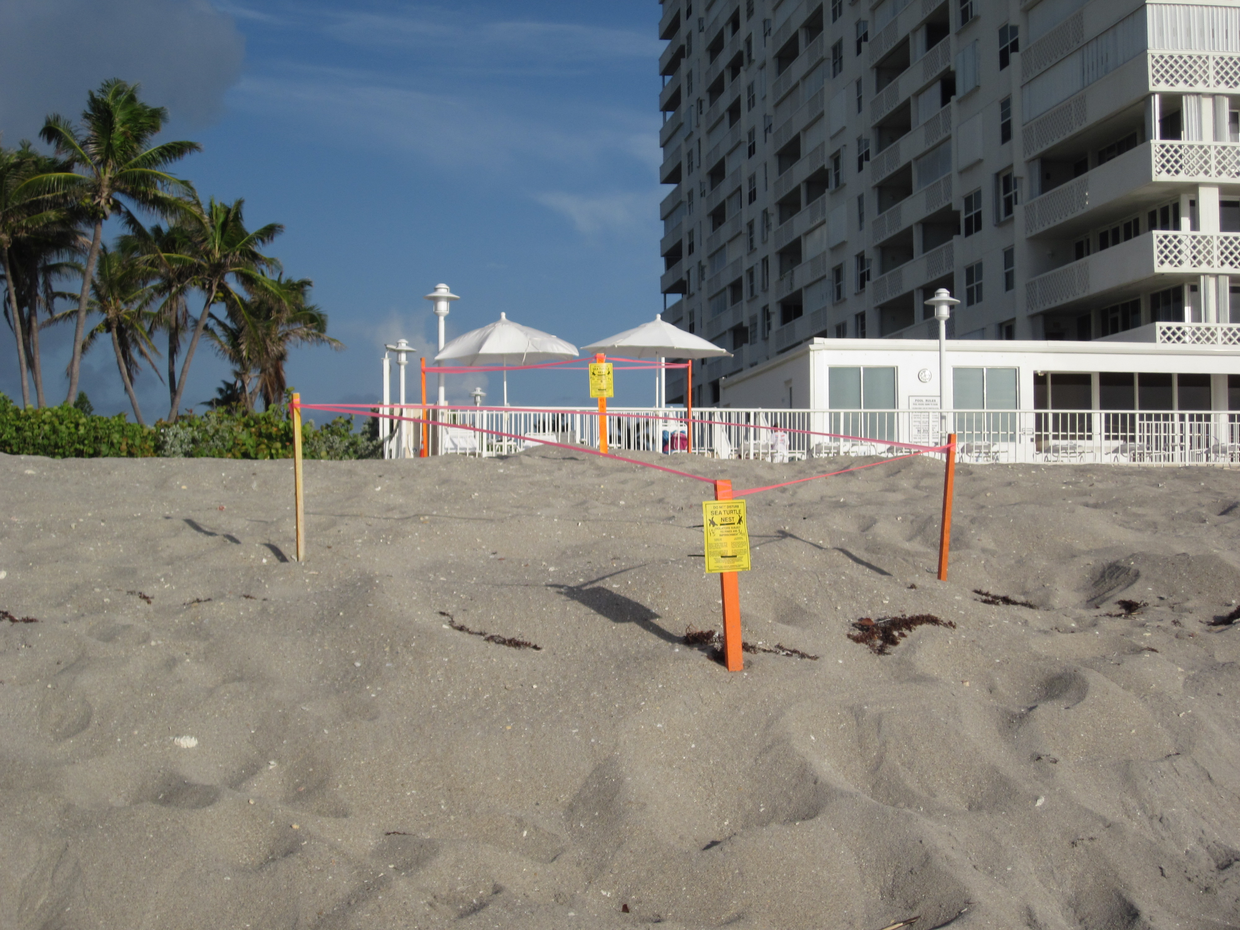
![By Conservation Measures Partnership (Open Standards for the Practice of Conservation) [Public domain], via Wikimedia Commons](http://en.wikipedia.org/wiki/Adaptive_management#mediaviewer/File:CMP_Cycle_-_2008-02-20.jpg)
Reminder - Complete all of the Module 13 tasks!
You have reached the end of Module 13! Double-check the to-do list on the Module 13 Roadmap to make sure you have completed all of the activities listed there.
References and Further Reading
- Coastal cities and sea level rise, Coastal Wiki
- Miami: Rising Seas, Sinking Infrastructure: Miami's Climate Conundrum. Kennedy School Review
- Frazier, T. G., N. Wood, and B. Yarnal. 2010. Stakeholder perspectives on land-use strategies for adapting to climate-change-enhanced coastal hazards: Sarasota, Florida. Applied Geography 30 (4):506–517
- NOAA Climate.gov: Restoring Surfer's Point