Estuaries
Estuaries- What is an estuary?
- How do estuaries form?
- What sort of processes takes place in estuaries?
Definition and Morphology of Estuaries
Coastal geologists define an estuary as a semi-enclosed body of water with an open connection to the ocean and one or more rivers flowing into it. They represent a transitional environment between the solid mainland and the sea and because of the inflow of rivers are partially diluted with fresh water so that they do not contain normal salinity marine water. As a transitional environment, they are influenced by marine processes, such as waves and tides, as well as river processes, such as the delivery of sediment and fresh water.
The Importance of Estuaries
Some of the world's most productive ecosystems are located within estuaries and host a wide range of organisms. In fact, many species of commercially important fish and shellfish spend part of their life cycle within estuaries before reaching maturity. They are, however, an environment that, like many other coastal environments, faces a wide range of environmental problems arising from land-use practices, dumping of sewage and other pollutants, and the introduction of excess nutrients because of poor agricultural practices.
Historically, estuaries have been classified a number of ways, including how they formed and their morphology, the circulation patterns that are present within the estuary, and the relative importance of waves and tides within an estuary. In this module, we will only be discussing estuary formation and circulation patterns of classification.


Estuary Formation
Estuary FormationDifferent ways that estuaries can form include:
- Ria Estuaries: rising sea level fills an existing river valley, such as what happened to create a special case of Ria known as the Coastal Plain Chesapeake Bay Estuary of the eastern U.S.A.
- Tectonic Estuaries: tectonic deformation of the Earth’s crust, such as faulting, creates a localized depression that fills in with marine waters such as San Francisco Bay. Water depths in tectonic estuaries can be highly variable.
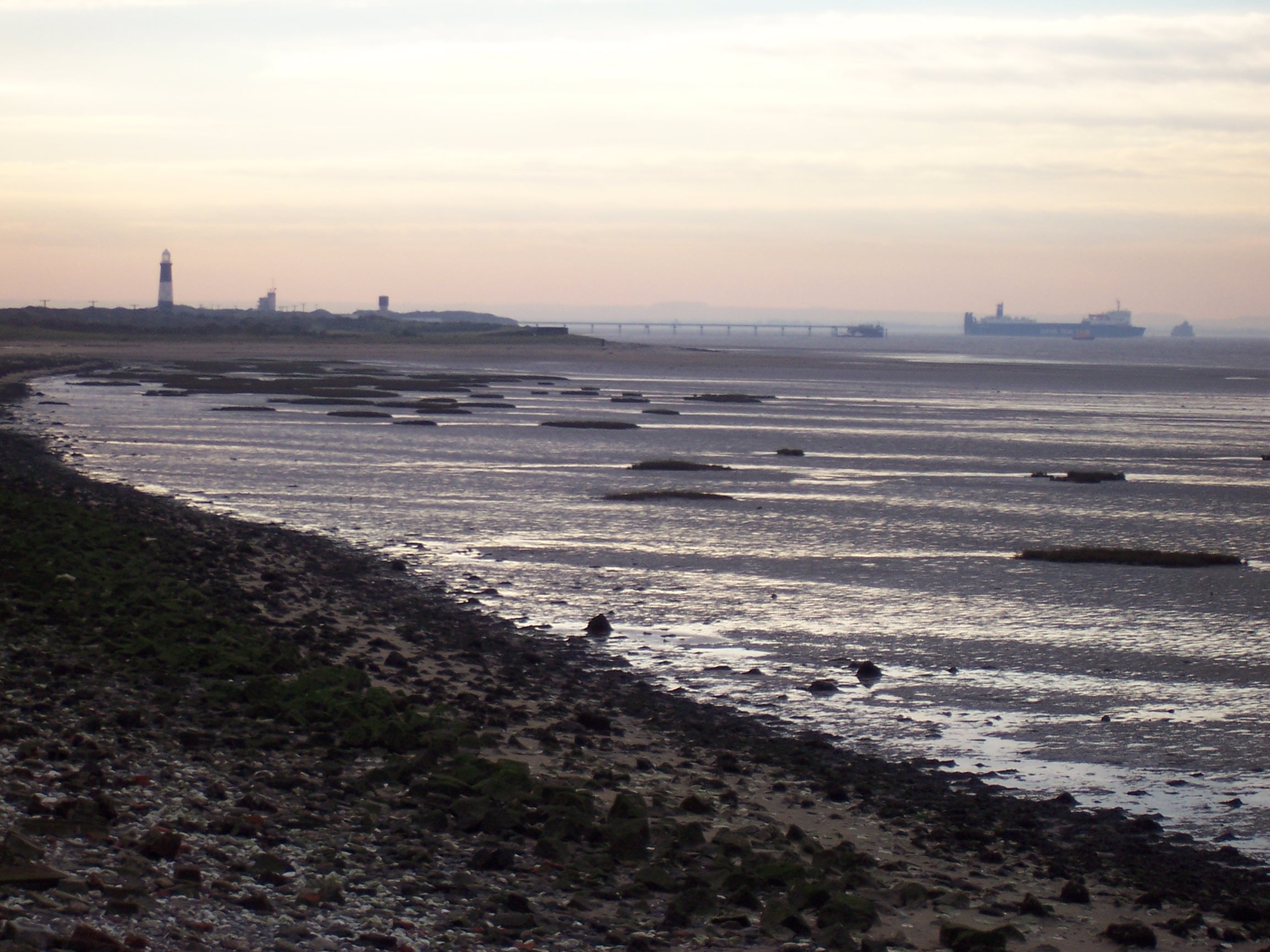
- Bar Built Estuaries: migrating barrier islands or spits extend across the mouth of a bay and restrict the amount of marine water entering the bay to create an estuary. They tend to be relatively shallow and typically less than 10m of water.
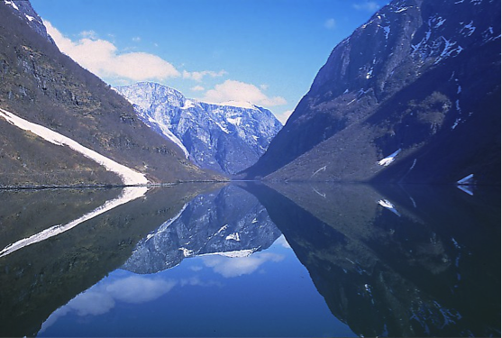
- Fjord Estuaries: glacially carved, U-shaped valleys that filled with marine water since the end of the last ice age. They can extend long distances 10s to 100s of kilometers and as deep as several hundred meters.


Estuary Salinity Patterns
Estuary Salinity PatternsThe relatively higher density of saltwater compared to freshwater means that freshwater will float on top of saltwater. In some cases, there may be mixing between the two water masses but, in other cases, little to no mixing may take place to produce a highly stratified water column with a layer of buoyant freshwater situated above a layer of saltwater. The development of a well-mixed estuary or a highly stratified estuary is a function of the estuary morphology, magnitude of freshwater input, estuary-mouth tidal range, and how the tide propagates up the estuary. A classic comparison is that relatively shallow, bar-built estuaries are often well-mixed, and, alternatively, deep, fjord-style estuaries are highly stratified. It is also important to note that besides there being a vertical profile of salinity variation possible, there are also variations along the length of the estuary. Near the mouth of an estuary, one would expect to generally find the highest salinity water where the influence of the sea is the greatest and the most freshwater at the most inland extent where freshwater river systems enter into the estuary. These variations in salinity structures lead to differences in the distributions of salt-water and fresh-water tolerant plant and animal species within an estuary and how organisms use the estuary environments.

Recommended reading for salinity
- Harte Institute for Gulf of Mexico Studies: Freshwater Inflows: An Estuarine System can be Classified by the Salinity Zone
Estuary Circulation Patterns
Estuary Circulation PatternsPatterns of estuarine circulation play an important role in sedimentation within the estuary and the distribution of different ecosystems in the estuary. Fundamental control on the types of circulation patterns can be linked to the relative relationships of freshwater input, the tidal range, velocity, and direction of winds, and currents created by waves. Each of these is capable of creating currents within the estuary and thus control how freshwater and saltwater interact in the estuary and where sediment can accumulate within an estuary. For example, during periods of low river inflow to an estuary, wind-driven saltwater may move farther into an estuary than it would during high river discharge into the estuary. During intervals of high freshwater runoff, freshwater, and sediment may extend well into the estuary and lead to sedimentation near the mouth of the estuary in a location where sedimentation by rivers is typically low.
Earth Complexity in Action: Estuaries
Earth Complexity in Action: EstuariesThe complexity of natural systems and the complexity of the interaction between the various spheres of the Earth is extremely evident when considering coasts and coastal systems.
Consider the potential for the complexity of salinity and circulation within an estuarine system, a partially enclosed coastal body of brackish water that has freshwater input by rivers and saltwater input by marine processes. The circulation of an estuary can vary substantially across a range of time scales such as daily, seasonally, or annually. Changes in freshwater input during periods of heavy rain, fluctuations in tides, or changes in the direction that the wind is blowing can all contribute toward how water moves around within the estuarine system. During periods of heavy rainfall, freshwater input may result in a much-lowered salinity in the estuary, whereas during periods of drought and strong onshore winds, salty water can be pushed into the estuary by waves and the salinity of the estuary increases. Complexity in an estuarine system exists because of the numerous interacting physical processes of the hydrosphere and atmosphere that act on the system.
Now, consider how this complexity may affect the anthrosphere or the part of the environment that is made or altered by humans for human activities or habitat. Suppose you were making a viable living, fishing oysters for commercial resale. Most oysters are relatively environmentally restricted, and too much freshwater can kill them, as can too much saltwater. Perhaps, one year, you are able to very successfully oyster fish an area of the estuary because the freshwater and saltwater input has been perfectly balanced to create optimal conditions for oysters very close to your home. The following year, there is so much freshwater runoff into the estuary that all of the oysters near to your home die or do not grow to the adequate size. As a result, you would have to travel to new locations in the estuary to find the optimal oyster growing conditions, something that might mean longer boat travel time for you and more fuel to get onsite, thereby reducing your net profit. So, the complexity of natural processes interacting with each other generates complexity for how society deals with these changes.
Summation
SummationThe complex interaction of estuary morphology, freshwater influx, waves, and tides leads to the diverse range of estuarine conditions and environments that exist on a global basis and that may exist daily to seasonally in an individual estuary. The high primary and secondary productivity of estuaries and the fact that they can provide an important buffer to inland communities and infrastructure against the open ocean make estuaries a critically important coastal system. Yet, many are at risk because of exploitation. The Chesapeake Bay estuary, for example, has experienced widespread degradation of fisheries because of damage to bay habitat from the introduction of excess nutrients and pollution, and extensive programs are underway to mitigate against the substantial damage that has already been done to the system.
For more information on estuaries, check out these links:
- Check out more information on estuaries.
- More details on human impacts are on this site: Hart Research institute for Gulf of Mexico Studies: Estuaries
- Watch a YouTube video about estuaries.
- Check out more information on the Chesapeake Bay.
Learning Check Point
Learning Check PointPlease take a few minutes to think about what you just learned then answer the questions below.